Mapping the Isthmus of Corinth: A Story Map

Last May I had the privilege of working with Albert Sarvis, Professor of Geospatial Technology at Harrisburg University (and a licensed drone pilot), in capturing low-altitude aerial photographs of the Isthmus of Corinth. Albert and I had collaborated for several years previous on the Digital Harrisburg project, an ambitious project that seeks to link all the individuals living in Pennsylvania’s state capital in the years 1880-1940 with encoded historical maps of the city. Our work together in the Corinthia was a new endeavor, designed to both support long-term research related to the Eastern Korinthia Archaeological Survey and learn about the complicated history of the human uses of the Isthmus from antiquity to the present. Although it rained steadily in the region last May, it was still as successful venture in capturing new perspectives on an historical landscape: look at the final image below to compare the ESRI default aerial imagery with the higher resolution drone survey.

It was also a successful collaboration of students and faculty of the humanities and digital technologies. I brought along 9 Messiah College students (mostly History majors and minors), and Albert brought one senior student in Geospatial Technologies, John Nieves-Jennings. My students had the rewarding experience of learning how drone survey works (and some exposure to the software Pix4D) while Albert’s student was able to connect digital applications to historical questions. John Nieves-Jenning not only ran many of the drone flights but captured the process of work through still images, textual description, and videos. For a senior project, John put together this interactive ESRI Story Map with videos and images of the Corinthia and the drone survey. If you turn on the volume, you can hear the whirring buzz of the drone as it hovers up and above the fields and quarries of the Isthmus. You can also see some live footage of our work and me trying to remember what I could about the history of Corinthian quarries.

We have received a permit from the aviation authority to undertake a second season of drone photography the week after next. Albert and I will be returning with one of his colleagues and students for additional fieldwork. Stay tuned for some updates from the field.

Dropping into Ancient Corinth (the CyArk and Google Partnership)

Years ago, a visitor to ancient Corinth (and other sites of Greece) had immediate access to most of the archaeological remains within the site. One could stand directly next to one of the standing columns of the Temple of Apollo, or even climb within the Fountain of Peirene, as I know a group of university students did two decades ago. Open access provided physical contact with remains thousands of years old, and the first-hand experience of exploring the complexities of ancient architecture, but this was not necessarily all good. There were dangers in letting visitors climb in and among the site’s entire remains, and the monuments themselves undoubtedly suffered for the wear. Eventually, the ropes, rails, and fences came, which bounded and directed the visitor’s experience, restricting access and keeping the visitor at a distance. At some sites, such as the fenced Lechaion basilica, fences effectively barred visitors from any access except during those rare times when the site opened its gates.

Digital environments are changing all of this again. While we cannot physically touch an archaeological site remotely, the advent of new tools for exploring sites from a distance mark an exciting development in archaeology today. You may recall that at the end of the excavation season in 2015, the ASCSA Corinth Excavations reported on efforts by members of CyArk — a non-profit that preserves cultural heritage sites through 3D modeling — to recreate the Peirene Fountain and Temple of Apollo. Last week CyArk and Google Arts and Culture announced a new partnership to make 3D models of Corinth and other archaeological sites around the globe available through its free digital archive. A gallery called Open Heritage features online exhibits and 3D models of sites and monuments. As the blog for Google Arts and Culture noted,

As part of this new online exhibition you can explore stories from over 25 iconic locations across 18 countries around the world, including the Al Azem Palace in war-torn Damascus, Syria and the ancient Mayan metropolis of Chichen Itza in Mexico. For many of the sites, we also developed intricate 3D models that allow you to inspect from every angle, using the new Google Poly 3D viewer on Google Arts & Culture.


Greek Reporter provides this brief overview of the work in Greece, with links to a TED Talk with Ben Cacyra, founder of Cyark.

Remote visitors to the Ancient Corinth Exhibition may with this slideshow “Explore Ancient Corinth Expedition” which explains how CyArk created their 3D models of Peirene Fountain and the Temple of Apollo (through LiDAR and photogrammetry) and showcases videos of late antique frescoes within the fountain of Peirene.

The expedition also links to pages that allows anyone to download the data. Here’s the lead page for the expedition:

In collaboration with the American School of Classical Studies at Athens and the Hellenic Ministry of Culture, CyArk documented the mythical Peirene Fountain and the Temple of Apollo in the city of Ancient Corinth, Greece. Survey of the extant structures was conducted primarily with LiDAR and both terrestrial and aerial photogrammetry. The surviving frescoes within the Peirene Fountain were surveyed with an Artec scanner, which measures the 3D shape of a surface using pulsating light and a camera system. CyArk’s digital documentation of the temple and fountain provided the ASCS with accurate and precise data on the current state of preservation for both architectural complexes. In particular, it was important to record Peirene which is currently closed to the public due to concerns surrounding its preservation. This work was made possible through the generous support of the Macricostas Family Foundation

Then go on to explore the interactive map that allows any viewer to drop the little yellow street view figure onto any of the photogrammetry points. Voila — anyone can actually move within the Fountain of Peirene for the first time in decades. You can also explore 3D models of the Temple of Apollo and Peirene Fountain.

Recall that Google has already made available interactive imagery of Ancient Corinth through its street view feature: you can drop into almost any street in the village anytime you want. Through its “photo sphere”, you can also drop into the archaeological site and have a look around.


The Open Heritage collection along with Google Maps provides another great opportunity for teaching students and the public outside of Greece about ancient Corinth.

Corinthian Matters on Twitter

A busy and full summer has yielded to an even busier academic semester as classes begin here in south-central Pennsylvania. My plate is full, but I have a little hope that I’ll be able to write an occasional blog this semester — and turn this site into a place for slow blogging and more substantive content. I’ve had some productive encounters with the Corinthia in recent months including drone photography near the Canal, EKAS survey data, and research related to a 19th century refugee colony on the Isthmus called Washingtonia (see Kostis Kourelis’ blog here). I’m also working with a student this year to develop our GIS data for the Isthmus and translate saints’ lives from Greek and Latin, among other things. Plus, I continue to encounter interesting stories about the ancient Corinthia via alerts and feeds.

In the meantime, I’ve created a twitter account for Corinthian Matters  (@corinthmatters) which is perfect for the modicum of time that I actually have to devote this semester. If you are on twitter, you can follow Corinthian Matters there. If that’s not for you, just scroll down and you’ll see the twitter feed embedded here on this website on the left side.

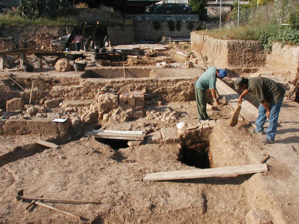
Corinth Excavations Archaeological Manual Published

Virtually anyone who has participated in the American School Excavations at Corinth has become acquainted with the Corinth Excavations Archaeological Manual. I’m not sure who was responsible for writing the first excavation manual for Corinth, or when it first appeared in print, but having an archaeological manual that guides fieldwork and recording is simply good archaeology. It gives workers and students help in making decisions in the field and ensures that excavation occurs in a responsible and systematic manner — producing data scholars can use to understand cultural deposits, buildings, and contexts and the formation processes that have transformed them. In the case of Corinth, a good printed field manual has been a constant guide for the student regular members of the American School of Classical Studies who come to the site every May-June for training.

2005 Excavations

The Corinth manual has grown over the years into a comprehensive and authoritative guide to open-area, stratigraphic excavation, covering everything from excavation of pits, wells, and robbing trenches to the removal of deposits to inventorying objects in the museum. The cohort of graduate students with whom I worked at the Panayia Field back in 2005 frequently referred to the paper versions of the manual in the field until the processes and guidelines became second nature. When I began excavating Hellenistic and Late Roman Cyprus in Cyprus with fellow Corinthian archaeologists in the Pyla-Koutsopetria Archaeological Project, we borrowed and adapted much of the Corinth manual to our excavations.

All this to say that the announcement today of the publication of the manual by The Digital Press of the University of North Dakota is great news. The work, authored by Guy Sanders, Sarah James, and Alicia Carter Johnson, with contributions by Ioulia Tzonou-Herbst, James Herbst, Nicole Anastasatou, and Katerina Ragkou is now available for free download at the the Digital Press website, or you can purchase a print paperback addition for a small cost. The publisher page describes the work in this way:

The Corinth Excavations Archaeological Manual is the first major field manual published from an American excavation in Greece and among a very small number of manuals published from the Eastern Mediterranean in the last generation. The appearance of this book is timely, however, as there is a growing interest in field methods and the history of excavation practices throughout the discipline of archaeology. Moreover, Corinth Excavations has long held a special place in American archaeology in Greece as the primary training excavation for graduate students associated with the American School of Classical Studies at Athens. As a result, the field manual has had a particular influence among American excavators and projects in Greece, among Mediterranean archaeologists, and in archaeology classrooms.

And the preface to the manual begins:

This manual describes the present state of archaeological practice at ancient Corinth, Greece. The system employed here has evolved over five decades of excavation and in response to both the nature of the anthropogenic activities and the ultimate goals of the excavation: a diachronic archaeological and cultural history of Corinth. The practicalities of removing archaeological material from the ground, recording it, analyzing it, and storing it for future use have been developed over the past 100-plus years of archaeological exploration, and they are well-suited to the field here, to the post-excavation methods used, and to the facilities available at Corinth.

I see a number of good, concrete benefits in this publication. It puts into (digital) print / final form the comprehensive methods of a major excavation in Greece at this point in time. There’s a tight relationship of course between process and product in archaeology: how you investigate the archaeological record relates in direct way to what you can say about past human activity. Indeed, I wish this new manual included a little historical and reflective overview of how excavation manual has grown and changed over time. Perhaps this could be included in subsequent editions, and I hope this publication might be followed by the publication of subsequent editions reflecting new developments in archaeological procedures.

The work will also be very valuable as a teaching tool. Besides its immediate uses in training American School students in the Corinth Excavations, I could imagine assigning this in my own class in Historical Archaeology. Certainly other professors who teach classical archaeology or archaeological method could use this work alongside other freely available archaeology manuals online (thanks, Bill Caraher!). But the publication could also be made available even in courses in textual fields such as New Testament studies that devote a little time to how archaeology contributes to our understanding of Roman cities. The work is rich in illustrations mostly produced by architect James Herbst. Check out the two below for examples.  

 
The publication of the Corinth Excavations manual marks another positive step toward a more reflexive archaeology that situates contexts, finds, and buildings in concrete contexts and processes of investigation. Congrats to the Corinth crew and the Digital Press in providing access to their work. For more information about the manual, check out Bill Caraher’s press release today.

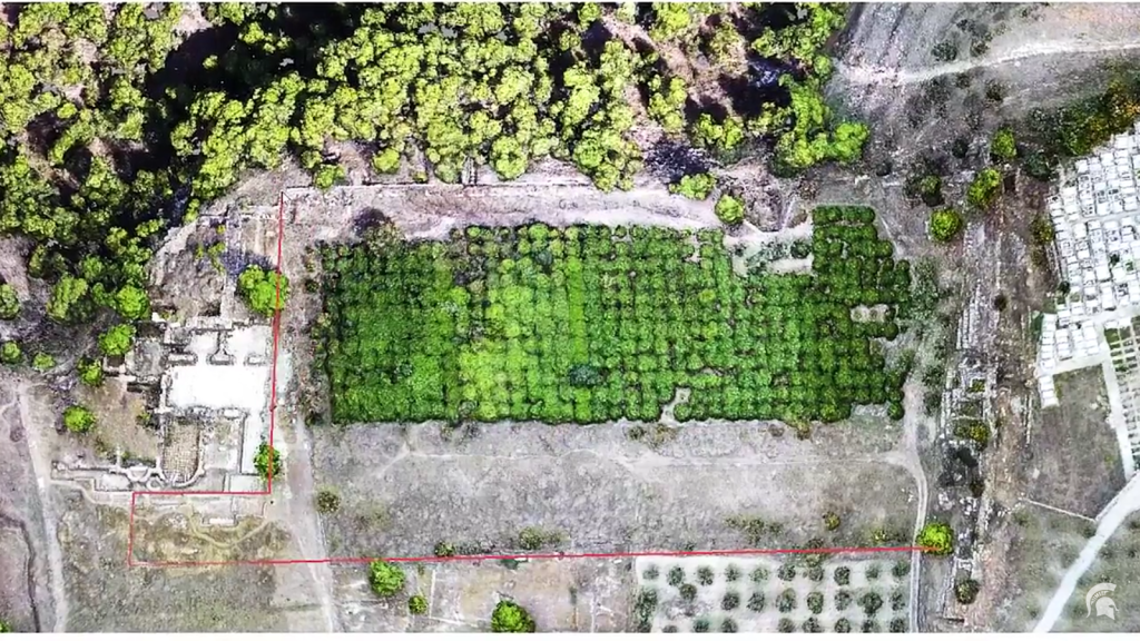
Digitizing and Droning Isthmia

Several years ago I wrote about the interesting work Professor Jon Frey of Michigan State University was doing with collaborators at Isthmia to digitize the excavation notebooks as well as the associated finds and context data. Over the last couple of weeks, MSU has spotlighted Frey’s recent work at the site including his discovery of a gymnasium at the site (now published in Hesperia, with Timothy Gregory).

The article, “Digital Dig: A New Discovery from Ancient Greece,” also includes a video of a drone survey at Isthmia carried out in the fall with James Herbst, Timothy Gregory, and others. This is a great example of innovative technology and digital tools shedding light on old data sets.

Here’s a taste of the cover piece:

Through the careful study of excavation records dating back some 40 years, Michigan State University’s Jon Frey has discovered an ancient gymnasium at the archaeological site of Isthmia, Greece.
 Frey and his team are performing a “digital dig” of sorts. Rather than using shovels and tools to excavate the site, the researchers are studying a backlog of evidence housed in remote storage.

“The neat part is there are many moments when we discover things that the original excavators missed,” says Frey, assistant professor of classical studies in the College of Arts and Letters. “So it’s kind of like our research has shifted from digging to detective work. We’re essentially re-excavating the archives.”

You can find additional videos about the work at Jon’s website, and The State News at MSU also did a separate writeup.

I embed one of the videos below.

Mobilizing the Past

When we decided to bring iPads to Cyprus for use in the 2012 excavation season of the Pyla-Koutsopetria Archaeological Project, we knew we were migrating into a new and uncertain digital future of archaeological research. My own initial encounters with the archaeological process (excavating prehistoric rockshelters and hilltop enclosures in southern Ohio) had involved recording notes in paper notebooks the old fashioned way. And when I crossed the pond and participated in archaeological surveys and excavations in Greece and Cyprus, there was lots of paper in forms, notebooks, instruction manuals, and end-of-season reports.

Our experience using mobile devices for collecting material in Cyprus gave us a sense of how fieldwork could be streamlined with digital media but also taught us not to give up on paper altogether (you can read a summary of our experiences here). In fact, we collected our data that year with both iPads and paper in the fear that some catastrophic data loss might send us back to the U.S. with nothing to show for our work.

Pyla-Koutsopetria Archaeological Project, Cyprus, June 1, 2012. Photo by David Pettegrew
A student uses an iPad to record data in the excavation of a Hellenistic site. From the Pyla-Koutsopetria Archaeological Project, Cyprus, June 1, 2012. Photo by David Pettegrew.

This new volume edited by Erin Averett, Jody Gordon, and Derek Counts and published by the Digital Press at the University of North Dakota is a welcome contribution to the scholarship surrounding digital archaeology. This major publication compiles contributions from leading practitioners in the field in a discussion about how mobile technologies (broadly defined) intersect with and affect archaeological practices.  With 20 articles that total 556 pages of text, the volume publishes a workshop at Wentworth Institute of Technology in early 2015 that was funded by an NEH Digital Humanities Startup Grant. Most importantly, the volume takes a critical and reflective (rather than utopian) view on mobile approaches in archaeology today. Here’s the book description:

Mobilizing the Past is a collection of 20 articles that explore the use and impact of mobile digital technology in archaeological field practice. The detailed case studies present in this volume range from drones in the Andes to iPads at Pompeii, digital workflows in the American Southwest, and examples of how bespoke, DIY, and commercial software provide solutions and craft novel challenges for field archaeologists. The range of projects and contexts ensures that Mobilizing the Past for a Digital Future is far more than a state-of-the-field manual or technical handbook. Instead, the contributors embrace the growing spirit of critique present in digital archaeology. This critical edge, backed by real projects, systems, and experiences, gives the book lasting value as both a glimpse into present practices as well as the anxieties and enthusiasm associated with the most recent generation of mobile digital tools….

While there are only a few references to Corinthian matters in the volume per se, you’ll see in the list of contributors a number of long-term contributors to Corinthian scholarship. And the work is certainly relevant to the various movements in the digital Corinthia which we have discussed here at Corinthian Matters.

If you’re interested, you can download the full volume or individual chapters at The Digital Press at the University of North Dakota.

Religion for Breakfast

If you are interested in issues of ancient religion and early Christianity, check out Andrew Henry’s YouTube channel “Religion for Breakfast.” Religion for Breakfast is (as the about page notes) an educational video log “dedicated to the academic, nonsectarian study of religion. We strive to raise the level of conversation about religion on YouTube by exploring surprising facts about humanity’s beliefs and rituals through an anthropological, sociological, and archaeological lens.” And the home page for the channel describes the purpose of the series in this way:

Religion for Breakfast believes everyone should know a little bit more about religion. It touches every aspect of human civilization—our art, politics, history, and culture. It has inspired some of our most ethereal music. It has motivated some of our greatest leaders. And, yes, it has also sparked some of our biggest wars and social injustices…

Andrew has an academic blog on the subject as well but his really original contribution is this YouTube channel that regularly releases short (2-10 minute), fast-paced, and jumpy video blogs designed to educate the public about the academic study of ancient religion. Influenced by educational videolog channels in the sciences (check out, for example, this PBS Space Time vlog on the speed of light and this CrashCourse vlog on the history of early Christianity), Andrew is a pioneer in applying this genre to ancient religious studies.

His series so far has included short videos on topics such as:

ReligionforBreakfastAnd while most of these concern religion generally–and not Corinth per se–at least a few are directly relevant to the Corinthian situation, including, for example, How to Make an Ancient Curse Tablet (cf. Stroud’s publication of curse tablets in Corinth XVIII.6) and Where did Ancient Christians Meet?, which begins with a survey on Acrocorinth and discusses meeting places in Corinth and other regions of the Roman Mediterranean.

And for some background: Andrew is an advanced PhD student in religious studies at Boston University with interests in the intersection of material culture and early Christianity. He has worked at the ASCSA Excavations in the Athenian Agora, and participated for a summer in the Pyla-Koutsopetria Archaeological Project, a project that Bill Caraher, Scott Moore, and I direct in Cyprus. I also had the privilege of working with Andrew during his brief stint at Messiah College.

These vlogs should be a great resource for use in the classroom and will be of interest for anyone who wants to know about the academic study of ancient religion.

With Passover and Orthodox Easter approaching, this marks our final post in a series about resources for the study of religion, Judaism, and Christianity in Corinth. Earlier posts include:


Ancient Corinth via Drone

After last month’s post about helicopter views of Corinthian coasts, I was pleased to discover Dronestagram, a site that allows owners of drones to share their photos and videos. This two minute sequence of the site of Ancient Corinth offers low-altitude coverage of the archaeological site as well as the Greek theater and Odeion. Now that the technology is available, expect many more of these in the future. These kinds of videos provide new perspectives on archaeological sites which will certainly be useful in the classroom.

CorinthDrone2
CorinthDrone3

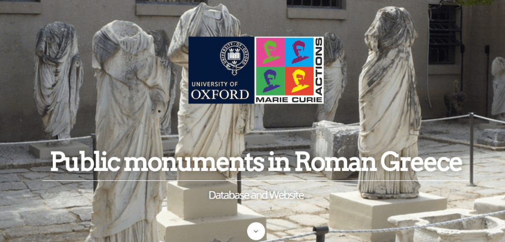
Public Monuments in Roman Greece: A New Database

A colleague sent me this link to Dr. Christopher Dickenson‘s new database and website devoted to the public monuments of Roman Greece. The platform and the content are still under development, but the website already makes available records for a substantial number of monuments known from Pausanias for three cities of Roman Greece. With its aim to presen all monuments known from text and archaeology, the site has the potential to offer a comprehensive and useful data set of statues, tombs, paintings, and dedications from the major cities of Greece between 200 BC and 200 AD. As Dickenson describes the project at his blog,

The basic premise behind my project is that not enough attention has been paid to the extent to which spatial setting contributed to the meaning of ancient public monuments. I’m interested in questions such as how setting up different types monument in the same space – for example statues of benefactors and gods in a city’s agora – might have had an effect on how such monuments were read and experienced, how different spaces were frequented by different groups of people who would have been the audience for these monuments.

The website home page describes the project in this way

Under the Roman Empire the marketplaces, streets, gymnasia and theatres of the cities of Greece were full of monuments such as tombs, inscribed stelai and – most numerous of all – statues. There were statues of bronze and of marble, portraying gods, heroes, emperors, kings and local dignitaries. Some of these monuments had already stood for centuries; others were fairly recent. Arguably no urban culture in history, with the possible exception of Rome itself, has set up such vast numbers of monuments in its public spaces. The nearest modern analogy for the amount of cultural material on display in the Roman period polis would be the museum. Yet the analogy falls short – the settings where these monuments stood were not places designed primarily for the passive viewing of works of art, they were vibrant public spaces, alive with the tumult and commotion of the city. If we are to understand the society and culture of these cities it is vital that we understand the impact of public monuments on the people who moved about them in their daily lives.

The aim of the project “Monuments of Roman Greece”, funded by a Marie Curie Fellowship from the European Commission is to explore the various ways in which the setting of public monuments contributed to giving them meaning, for instance, by looking at how certain types of monuments were positioned in relation to spaces used for certain activities in order to target particular audiences and at how monuments were positioned in relation to each other to create meaningful connections. This investigation will cast new light on questions such as the nature of power within the polis community and how local identity was defined in the face of imperial rule. The results will be published in a series of articles. At the heart of the project is a database of monuments known from archaeological, epigraphic and literary evidence to have stood in the cities of Greece in Roman times. The database is a work in progress and is still being expanded but has been made available online here as a tool for other researchers.

RomanGreeceMonumentsThe database page of the website notes that the current database contains all the public monuments from Athens, Corinth, and Messene mentioned by the travel writer Pausanias in the second century AD. The database itself includes 340 records for armour, paintings, figures, statues, and monuments. Each record includes a range of content and metadata such as type; find spot, attestation, found in situ; type of public space; spatial setting; specific location; date erected; last date attested in situ; statue size; dimensions; notes; bibliography; and images. You can search for a monument by clicking on “Find” and “Perform Find.” The current web search interface is clunky but functionality should come over time.


For more information, see Dickenson’s blog post about the potential of the research database and the problems of categorization, the major issue confronting anyone who dares to create an archaeological gazetteer of sites known from both textual and archaeological evidence. Dickenson is currently seeking recommendations — should you have any.

Crowdsourcing Paul’s Letters to Corinth

Last week I noted a few of the many new tools and online sites available for reading and interpreting Paul’s Corinthian correspondence. I was a little surprised to find so few digitally annotated commentaries on 1 and 2 Corinthians given the relative ease of coding a text through TEI markup language, the availability of online platforms that have simplified the process, and the currency of crowdsourcing in the digital humanities. One can find commentaries through subscriptions in biblegateway, of course, but there are now platforms available for producing collaborative crowdsourced commentaries.

Consider Genius, a site freely available for annotating musical lyrics. Their website claims to have made available annotations of literally millions of songs that include “all of Kanye and Kendrick, but also Hamlet, TV and movie scripts, Kurt Cobain’s suicide note, and even the Chipotle menu…”. The platform allows users to highlight difficult or obscure lyrics, annotate, comment, and add context and images to help individuals make sense of text. The site also provides a Genius Web Annotator which, through a Chrome extension, gives users the ability to mark up any internet page, make one’s own website annotatable, and easily share annotations with anyone. The website already has many Corinthian-related texts uploaded by their user community including Pausanias’ Book 2, Lord Byron’s “Siege of Corinth,” and chapters from modern scholarship such as Dale Martin’s The Corinthian Body.Genius

For one successful model in using Genius to mark up the Corinthian correspondence, check out Professor Laura Nasrallah‘s commentaries on the Pauline epistles and the Corinthian correspondence crowdsourced by Harvard University undergraduates. Nasrallah’s guide for students includes both practical suggestions such as formatting and multimedia, as well as contextual questions for students to consider as they annotate:

  • What is the significance of the historical context of the political power of the Roman Empire?
  • What is the significance of the socio-economic context of the first century CE?
  • What do the various arguments within the Pauline correspondence reveal about the debates in which the earliest Christians were engaged?
  • How does your experience help you to bring new interpretive contexts and to ask better questions?

CrowdsourcedCorinthiansNasrallah’s student commentaries build on earlier semesters with the result that students may interact with earlier classes. You can see the full list of Nasrallah’s annotated chapters and books here.

Crowdsourced platforms such as Genius have a wide range of potential uses that include but go well beyond academic contexts for reading Corinthian texts. Virtually any group or community could use such a platform for a collaborative study of 1 and 2 Corinthians. And it would be great to see someone put together a digital patristic commentary on these letters–an online version of Gerald Bray’s ancient Christian commentaries on 1-2 Corinthians. If you have worked to digitally annotate these letters, send me a link and I’ll add it a static webpage when I convert some of these posts into more static pages.

This is the sixth post in a series on resources for the study of ancient religion and Christianity in Corinth. Earlier posts include: