Few remains survive today from the Roman Emperor Nero’s great endeavor to cut a canal through the Isthmus of Corinth. This is surprising and unfortunate since the initiative marked one of the most ambitious undertakings of Nero’s reign and arguably one of the emperor’s principal reasons for touring Greece in 66-68 AD. The work at the Isthmus probably lasted well over a year and involved a work force numbering as many as 10,000 slaves, political prisoners, soldiers, and conscripted laborers. The emperor and a labor force this substantial must have transformed the region in ways that it are hard for us to grasp today.

Before the late 19th century construction of the Corinth Canal (1881-1893), one could still see vestiges of the ancient remains. European travelers commonly reported ditches, trenches, pits, and mounds on both the eastern and western sides of the neck. A late 17th century map included with Richard Chandler’s overview of the territory (1776), for example, shows a line of ditches and mounds over the western third of the Isthmus. Colonel Martin Leake measured the width of the canal trench near the Corinthian Gulf at about 200 feet wide and 1,200 yards long , extending across the low coastal zone and terminating where the land begins to rise. Other travelers noticed towering mounds of earth and debris that were many meters high.
The only person to conduct a systematic survey was Béla Gerster, the architect from Hungary who was largely responsible for planning and executing the modern Corinth Canal. Gerster carefully investigated the ancient remains as part of his planning for constructing the modern canal and documented trenches on both sides of the Isthmus and pits across the ridge. He published his findings initially in a BCH article, which he later revised and expanded in his 1896 book on the modern Corinth canal.

It is hard to appreciate today how much the 19th century canal project transformed the topography of the Isthmus. Through the use of dynamite and locomotives, the work crews extracted 11 million cubic meters of earth and stone over little more than a decade and spread it across the region. Much of the coastal zone on both gulfs today is elevated above sea level through dumping. There are even little neighborhoods close to Isthmia that are built on artificial ridges created from canal debris; in some cases, modern work crews simply used the ancient debris mounds for dumping their own materials. Transformations continued in the 20th century: the strategic importance of the Isthmus to the German occupation of Greece, especially, generated bunkers, camps, and more movements of earth. All of this explains why very little remains today from the ancient canal. A couple of students and I walked across the Isthmus in 2014 to see if we could locate any of the features in Gerster’s 1884 map and were reminded just how extensively humans had remade the territory in the last 130 years.

There are a few exceptions, which prove interesting. Near the start of the so-called diolkos of Corinth on the Corinthian Gulf, one can see in the water at the canal’s edge a broad sloping “platform” created by flat slabs. When Harold Fowler discussed this area in his topographic survey of the Corinthia (1932, p. 51), he recorded its dimension as about 40 meters long. Scholars have usually associated the zone with the diolkos (Sector A), but Koutsoumba and Nakas have made a compelling case that this actually should date to Nero’s canal project (among other things, they point out that it follows the same orientation as the modern canal and has no clear architectural relationship to the portage road 20 meters to the south).

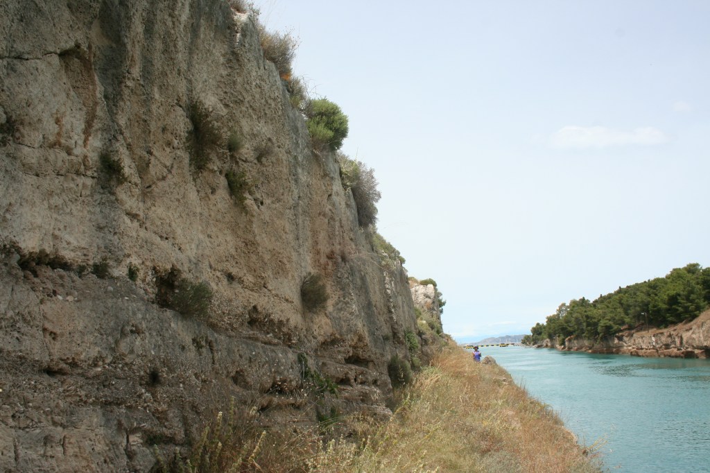
On the Peloponnesian side of the canal, as one walks eastward along the canal from the Corinthian Gulf, some of the visible limestone and standstone walls belong to the original (rather than 19th century) canal works of Nero. As Wiseman originally noted, and I have seen myself, one can actually see marks of ancient chiselling. It was on the Corinthian Gulf side that the Roman canal crews made the greatest progress–excavating a canal hundreds of meters through both alluvial sediments and, in higher elevations, sandstone and limestone overburden.

The most interesting remains of Nero’s project, however, can be found opposite a stone foundation for an old (railroad?) bridge. The photo below, taken from the Peloponnesian side of the canal, shows one of those foundations on the Greek mainland side of the canal. There is a parallel foundation on the Peloponnesian side.

Here is some perspective of that area from the old gravel road on the Peloponnesian side. In the picture below, I have circled in red the stone foundation for the bridge.

Below this bridge foundation is the ancient canal wall and the famous Nero relief [Visitors should take care: the canal wall cliffs in this area are not insignificant], which has eroded even further since James Wiseman’s discussion of it 40 years ago (see figures below). The relief shows a man standing beneath a pediment with left arm resting on a thick object and right arm folded in. The photo can be interpreted (as Wiseman noted in 1978) either as an image of the Emperor Nero, or as a relief of Heracles resting from his labors. The most convincing interpretation in my view (and the argument I advance in The Isthmus of Corinth) is that it represents Nero as Heracles, who is in fact at the end of his labors.


While not much remains to this day, the record of remains by Gerster and earlier travelers allows one to reconstruct how Nero’s engineers approached the seemingly impossible task of transforming the maritime properties of the ancient landscape.

Leave a comment