Category: Sites, Canal
-
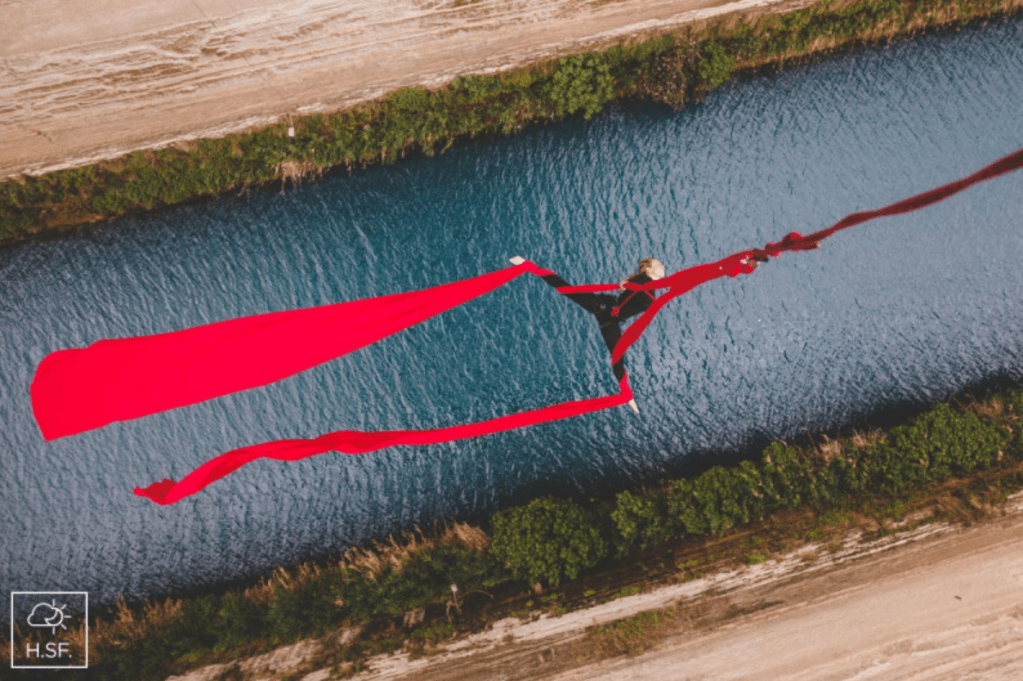
More Extreme Sports: Aerial Dancing over the Corinth Canal
I missed this event last but it certainly deserves a place among my growing collection of extreme sports on the Isthmus of Corinth. Modern dancer Katerina Soldatou aerial dances over the Corinth Canal. The Greek Reporter noted that “dancer and yoga instructor Katerina Soldatou…carried out a breathtaking performance of extreme aerial dance suspended above the…
-

A Coin Hoard at Lechaion is not the Real Story
Some more Corinthian clickbait hit us last week in a series of news articles about a coin hoard from Lechaion. We have heard quite a bit in the past about the Lechaion Harbor Project (LHP), a Danish and Greek operation to document the underwater remains at Lechaion since 2013. Their press releases, which come at the…
-

Collapse at the Corinth Canal
May you never find yourself along the Corinth Canal during a rainstorm. Torrential rains last Monday led to massive collapse of stones and debris about the midpoint of the canal, just beyond an old pedestrian bridge and near the old German bunkers. The canal is scheduled to be out of service for fifteen days while…
-
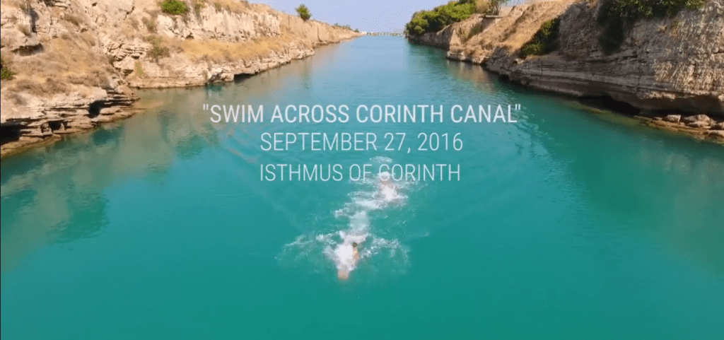
Swim the Corinth Canal
Add this to your list of things to do the next time you go to the Corinthia in September: Swim the Corinth Canal. According to this little blurb in ekathimerini, last week’s Swim the Canal event marked the first time the canal had been used for a swim race since its construction in 1893. No wonder: this year’s swim covered 6 kilometers. The organization webpage,…
-
On the Remains of Nero’s Corinth Canal Project
Few remains survive today from the Roman Emperor Nero’s great endeavor to cut a canal through the Isthmus of Corinth. This is surprising and unfortunate since the initiative marked one of the most ambitious undertakings of Nero’s reign and arguably one of the emperor’s principal reasons for touring Greece in 66-68 AD. The work at the Isthmus…
-

Helicopter Rides along the Corinthian Coasts
A website called tripinview claims to be the world’s first visual travel website, whcih makes available 800,000 photos of 300 hours of video of Mediterranean coastline. You can map and search, build a trip, or take the website’s highlight tours from the air. The site offers extensive coverage of Mediterranean coastal territory including fantastic footage of the Corinthia. Searching via the keyword “Corinthia” turns…
-
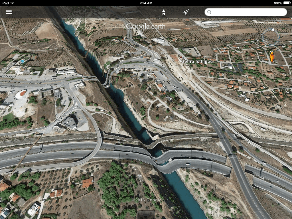
Elastic Roads
Google Earth provides excellent satellite imagery and aerial photographs of the Corinthia, but the service seems not to have done so well in reconciling the built features of the landscape with the topography in the area of the Corinth Canal. My six-year old and I were flying around the Isthmus and discovered the distortion in imagery that makes the national…
-
The Triton makes a Way
-
Target Corinth Canal
This new book by Platon Alexiades is the first of its kind to narrate the important role of the Corinth Canal in Allied and Axis operations during World War II. Target Corinth Canal: 1940-1944 (Pen and Sword, 2015) offers a narrative of the canal’s central place in the logistics of supply and control between 1940 and 1944. I tried unsuccessfully to obtain a…
-
An old dream realized at last, ship-canal through isthmus
The Library of Congress continues to build its collections of prints and photographs with a few Corinthian ones among them. I love this old stereo card print from 1906 showing the Corinth canal, opened little more than a decade earlier on July 25, 1893. Metadata from the Library of…
