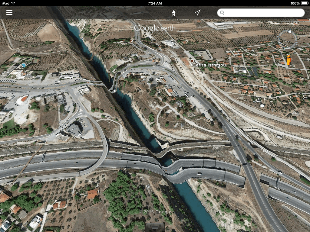
Google Earth provides excellent satellite imagery and aerial photographs of the Corinthia, but the service seems not to have done so well in reconciling the built features of the landscape with the topography in the area of the Corinth Canal. My six-year old and I were flying around the Isthmus and discovered the distortion in imagery that makes the national highway and railway look like a themepark roller coaster. Have no fear: the roads over the canal are perfectly flat, or at least they were the last I checked.


Elastic Roads
by
Tags:

Leave a comment