Good maps of the Corinthia are not always easy to find online. Google searches turn up plenty of tourist maps available from different tourism offices, but these are usually not the best for presentation and teaching. The following pages provide some convenient starting points for discovering maps of the Corinthia:
- The American School of Classical Studies website offers a large collection maps and architectural drawings of Corinth and its immediate territory via this search.
- The “maps” category at this site turns up blog posts about historical and modern maps.
Maps of the Corinthia
I also offer the following gallery of topographic maps of the Corinthia that I have created for different reasons. The gallery on this page offers maps freely available for educational purposes and public presentation of research. Maps labeled with “SRTM” make use of topographic data downloaded from the CIAT-CSI SRTM website. Please see this link for information about how these contours were created. If you would like to use any of these maps for publication, please contact me for appropriate citation.
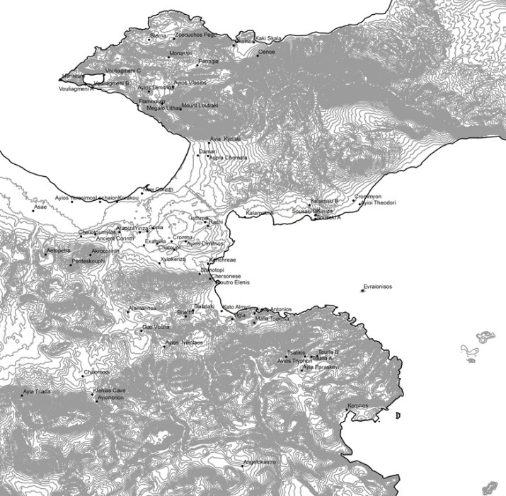
Base Map of Corinthia, 20 m contours (SRTM data), with archaeological sites 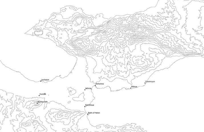
Base Map of Corinthia, 100 m contours with major archaeological sites (SRTM data) 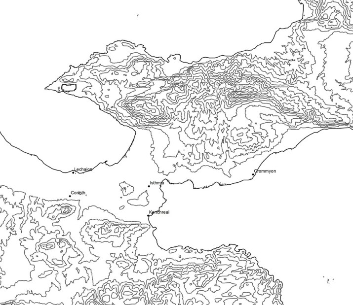
Base Map of Corinthia, 100 m contours with major archaeological sites (SRTM data) 
Base Map of Corinthia, 20 m contours (SRTM data) 
Base Map of Isthmus, 100 m contours (SRTM data) 
Base Map of Isthmus, 20 m contours (SRTM data) 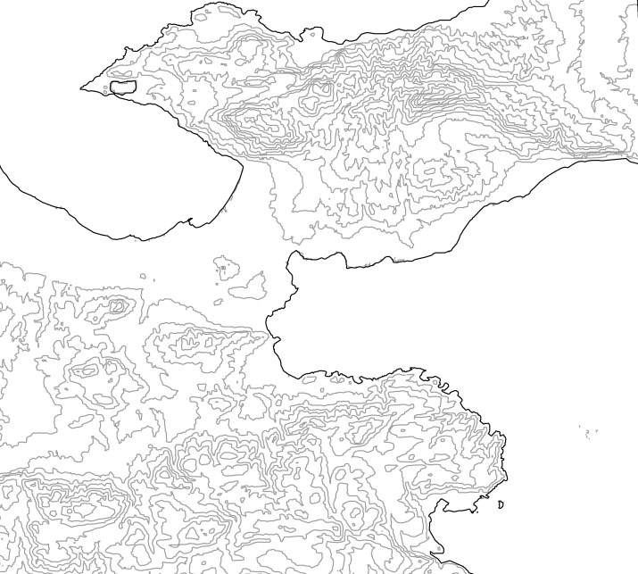
Base Map of Corinthia, 100 m contours (SRTM data) 
Base Map of Corinthia, 20 m contours (SRTM data) 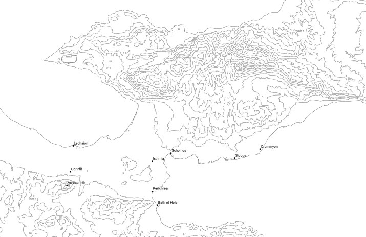
Corinthia known to Pausanias, 100 m contours (SRTM data) 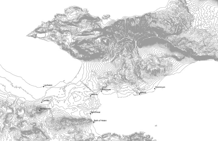
Corinthia known to Pausanias, 20 m contours (SRTM data) 
Ancient and Modern Sites of Isthmus (100 m contours, SRTM data) 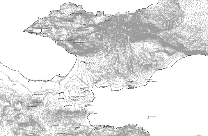
Ancient and Modern Sites of Isthmus (100 m contours, SRTM data) 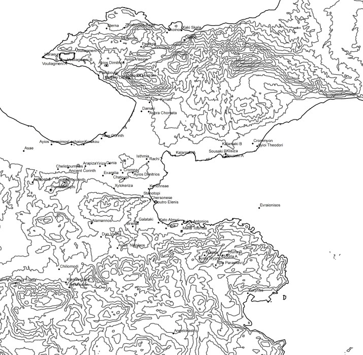
Ancient and Modern Corinthian Sites (100 m contours, SRTM data) 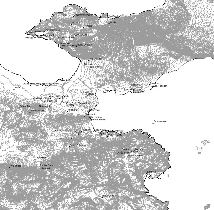
Ancient and Modern Corinthian Sites (20 m contours, SRTM data) 
Ancient and Modern Corinthian Sites (Unlabeled, 100 m contours, SRTM data) 
Ancient and Modern Corinthian Sites (Unlabeled, 20 m contours, SRTM data) 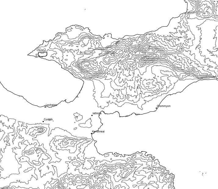
Corinthia, with major ancient sites (100 m contours, SRTM data) 
Corinthia, with major ancient sites (20 m contours, SRTM data) 

Map of Lechaion harbor, showing lines of settlement (after Romano 2003) 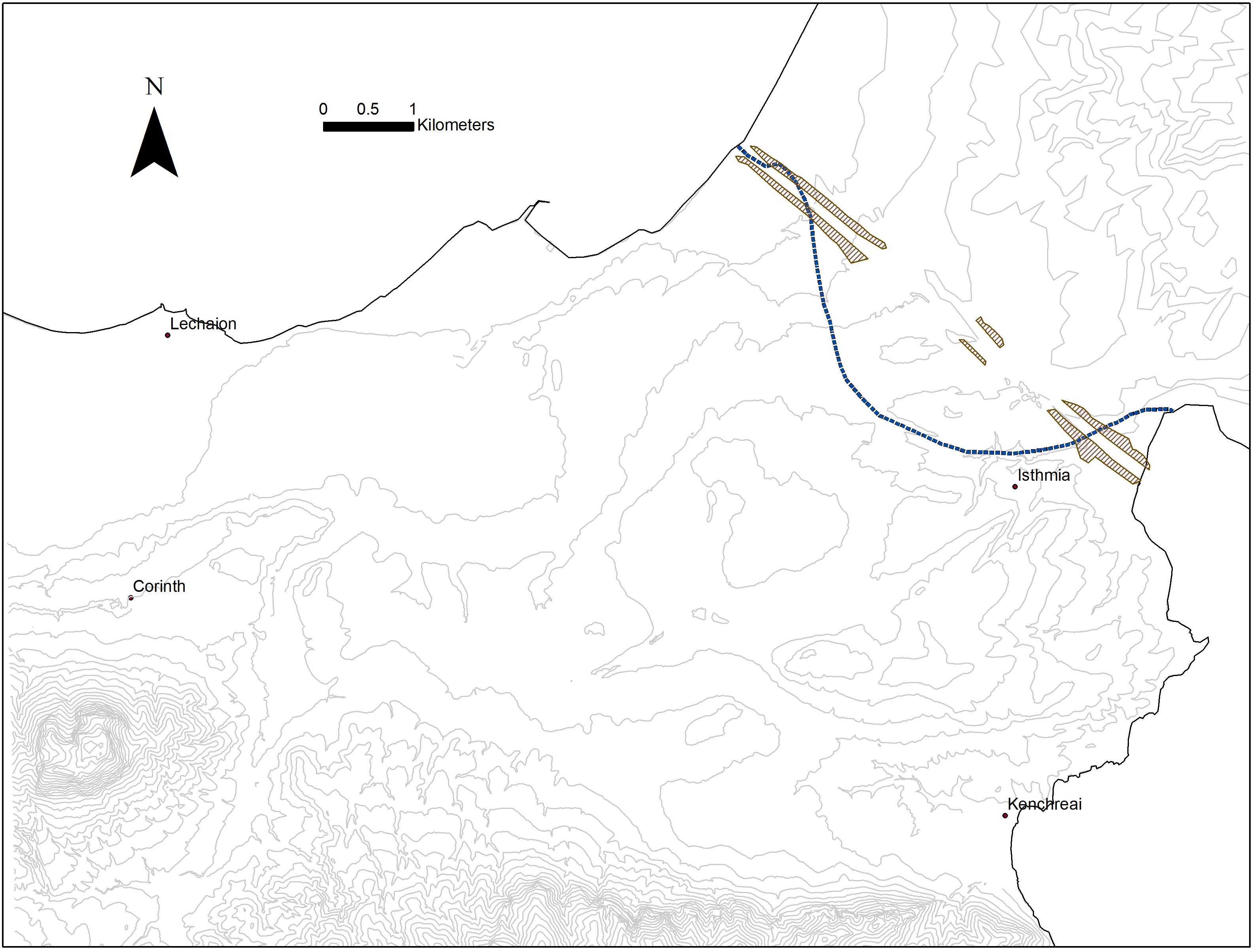
Diolkos and Nero’s Canal Cuts (after Gerster 1884, Raepsaet 1993, Werner 1997) 
The main transect of the Eastern Korinthia Archaeological Survey (1999-2001) 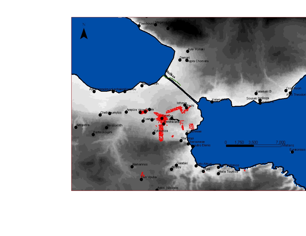
Map of EKAS transects on Isthmus of Corinth 
Map of Corinthian Isthmus with ancient and modern Sites 
Map of Major Ancient Sites on Corinthian Isthmus 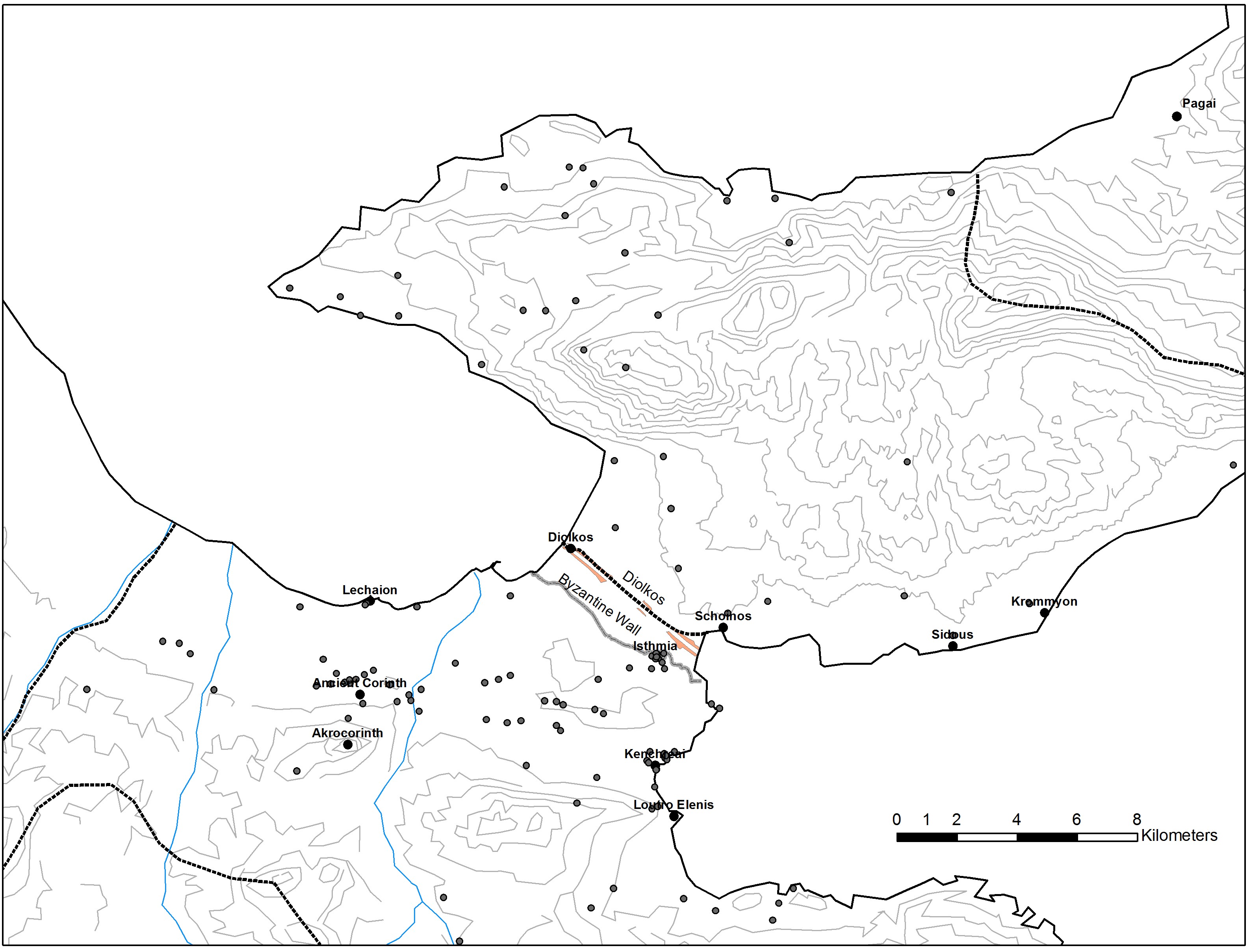
Known sites of the Corinthian Isthmus 
Two Interpretations of the path of the Diolkos (after Werner 1997 and Raepsaet 1993)
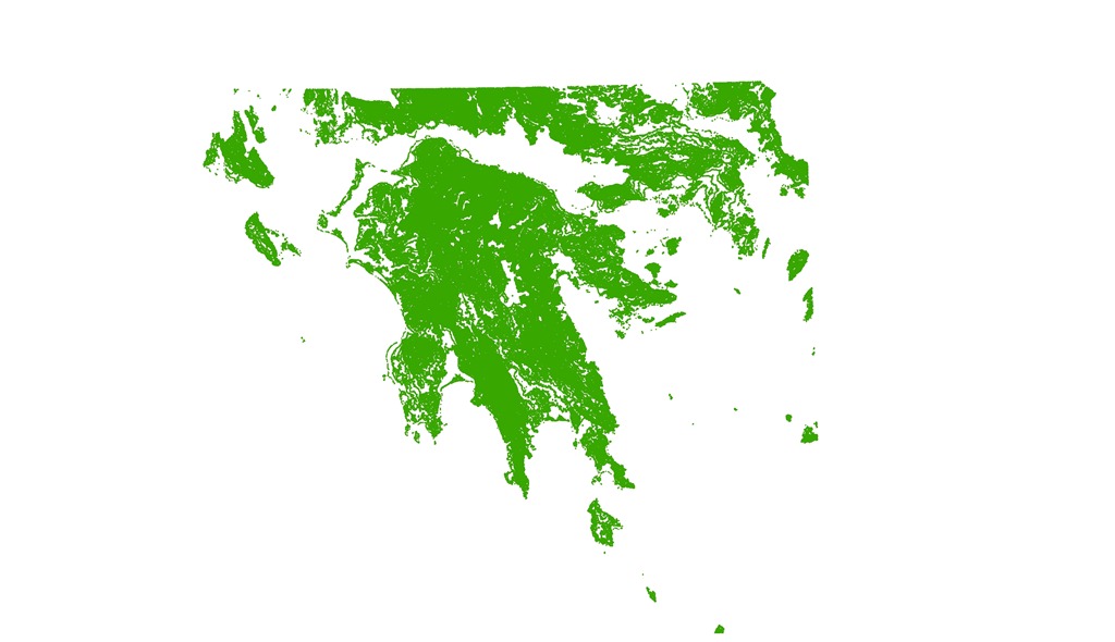
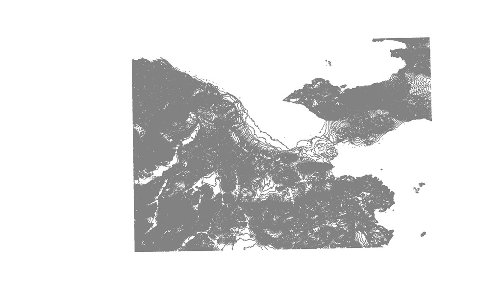
Contours of Greece
At the bottom of this page you will find links to downloadable 20 m. and 100 m. contours for the Corinthia and central and southern Greece. The process of generating these contours were discussed through two posts:
The SRTM data used to generate these contours came from a digital elevation model downloaded from the CGIAR Consortium for Spatial Information website. According to their disclaimer about liability, distribution, and acknowledgement/citation, these contours are freely available for (non-commercial) educational and research purposes, but users should cite the data source for publications and reports, as follows:
Jarvis A., H.I. Reuter, A. Nelson, E. Guevara, 2008, Hole-filled seamless SRTM data V4, International Centre for Tropical Agriculture (CIAT), available from
http://srtm.csi.cgiar.org.”
The disclaimer requests that users cite this data in publication, especially, and link to the CIAT-CSI SRTM website (http://srtm.csi.cgiar.org).
Extent and Coverage
The images below display the extent of the contours made available here. The first shows the extent of contour coverage for southern and central Greece, the second for the modern regional unit of the Corinthia (and western Attica), which includes the ancient territories of Corinth, Sikyon, Tenea, and Megara.
DATA SETS
The ZIP files each contain a package 7 individual files that are needed for recognition by ArcGIS. Right click on the file and save to your computer.
- Southern and Central Greece at 20 meter contours:peloponnese_20m_contours_srtm_41_05.zip
- Southern and Central Greece at 100 meter contours:peloponnese_100m_contours_srtm_41_05.zip
- Corinthia at 20 meter contours: korinthia_20m_srtm_41_05.zip
Enjoy, but please remember to cite the CIAT-CSI SRTM website for publication and presentation, and this page for acknowledgement of distribution.
