Category: Isthmus
-

Publishing the Eastern Korinthia Survey
One of the long-standing projects I have been working on over the last year is a book-length publication interpreting the results of the Eastern Korinthia Archaeological Survey. EKAS was a survey carried out from 1997-2003, with study seasons continuing to recent years. Unlike the more common survey project carried out in marginal territories or regions…
-

A Week in the Corinthia
I recently returned from a week-long stint in the Corinthia. Every day I spent in the region was amazing. The weather was beautiful and perfect for archaeological fieldwork and the landscape was more stunning than I had remembered. The research itself was rich, varied, and fruitful. I flew drones. I had coffee and lunch with…
-

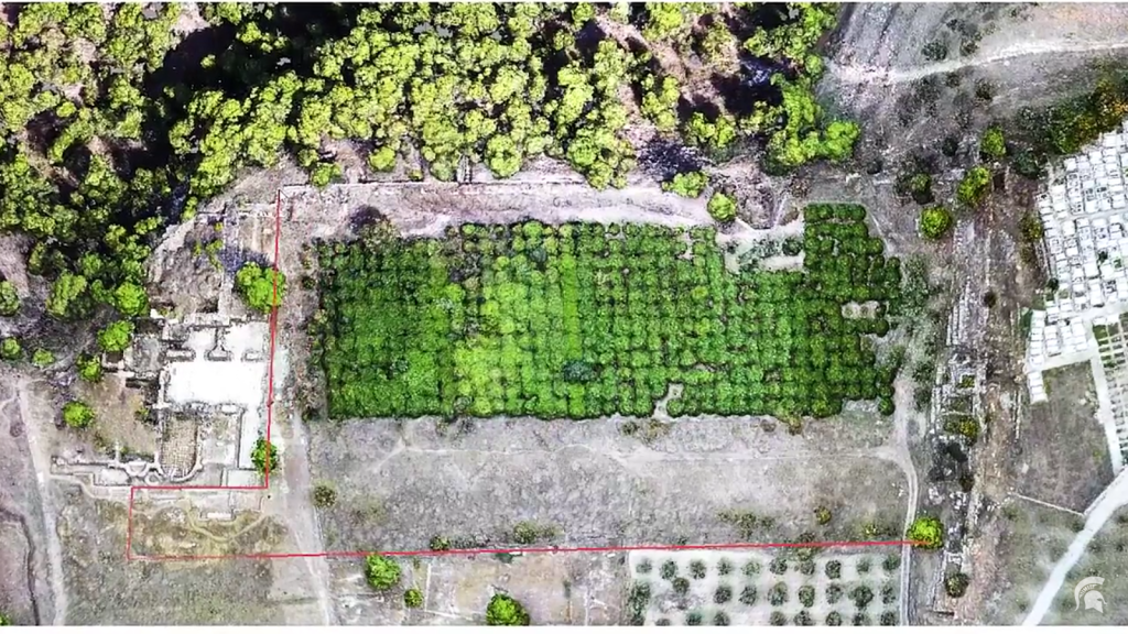
Mapping the Isthmus of Corinth: A Story Map
Last May I had the privilege of working with Albert Sarvis, Professor of Geospatial Technology at Harrisburg University (and a licensed drone pilot), in capturing low-altitude aerial photographs of the Isthmus of Corinth. Albert and I had collaborated for several years previous on the Digital Harrisburg project, an ambitious project that seeks to link all…
-

A Coin Hoard at Lechaion is not the Real Story
Some more Corinthian clickbait hit us last week in a series of news articles about a coin hoard from Lechaion. We have heard quite a bit in the past about the Lechaion Harbor Project (LHP), a Danish and Greek operation to document the underwater remains at Lechaion since 2013. Their press releases, which come at the…
-
Digitizing and Droning Isthmia
Several years ago I wrote about the interesting work Professor Jon Frey of Michigan State University was doing with collaborators at Isthmia to digitize the excavation notebooks as well as the associated finds and context data. Over the last couple of weeks, MSU has spotlighted Frey’s recent work at the site including his discovery of a gymnasium at the site (now…
-
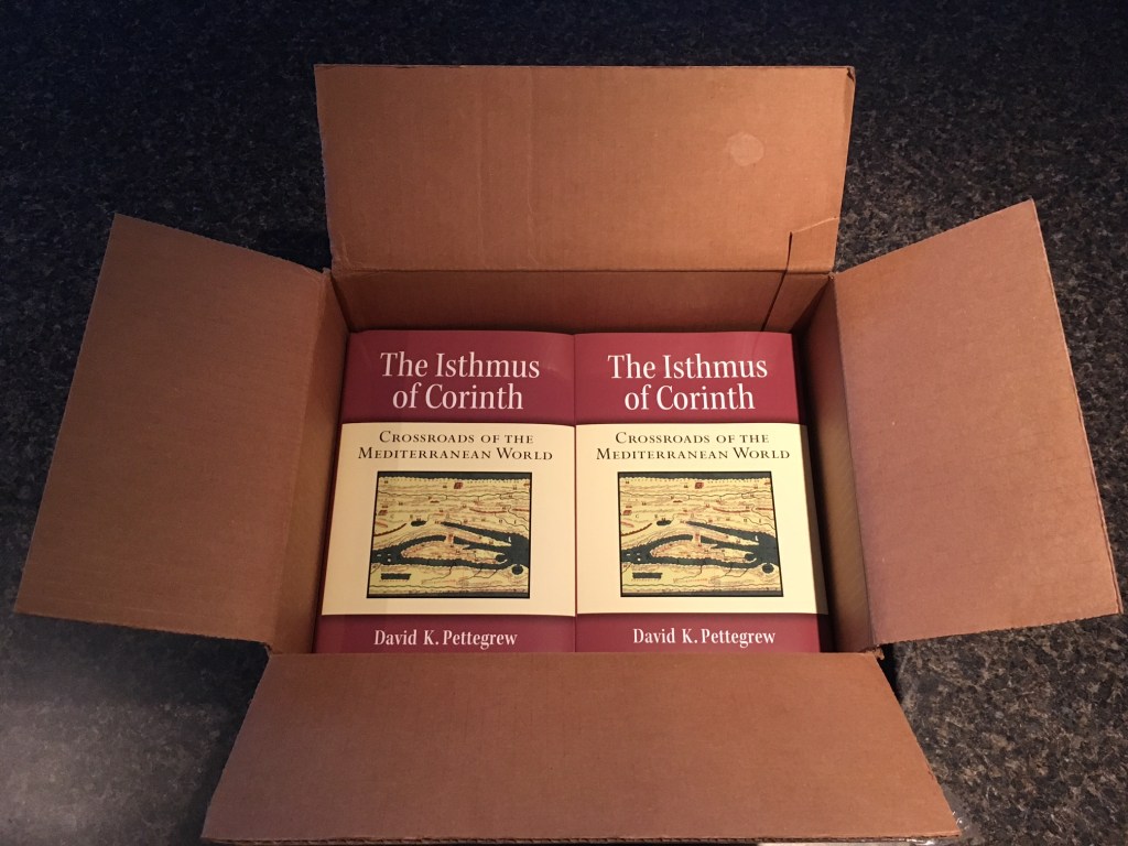
Box of Isthmus
Corinthian Matters is officially in vacation mode as our site’s regular visitors participate in archaeological fieldwork and travel, sip frappes or lie on beaches, and generally take some vacation time. I myself am teaching an online history class, working on a new research project, spending time with the kids, and taking it a little easier. But don’t worry: I’ve got my eyes on new Corinthian scholarship andnews items…
-
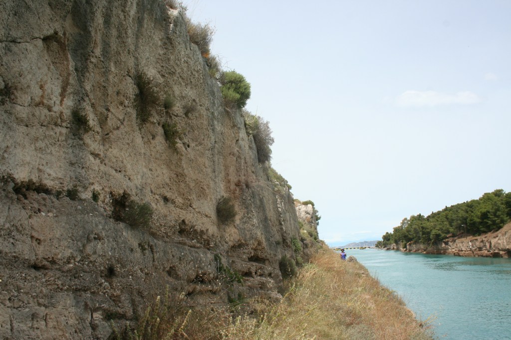
On the Remains of Nero’s Corinth Canal Project
Few remains survive today from the Roman Emperor Nero’s great endeavor to cut a canal through the Isthmus of Corinth. This is surprising and unfortunate since the initiative marked one of the most ambitious undertakings of Nero’s reign and arguably one of the emperor’s principal reasons for touring Greece in 66-68 AD. The work at the Isthmus…
-
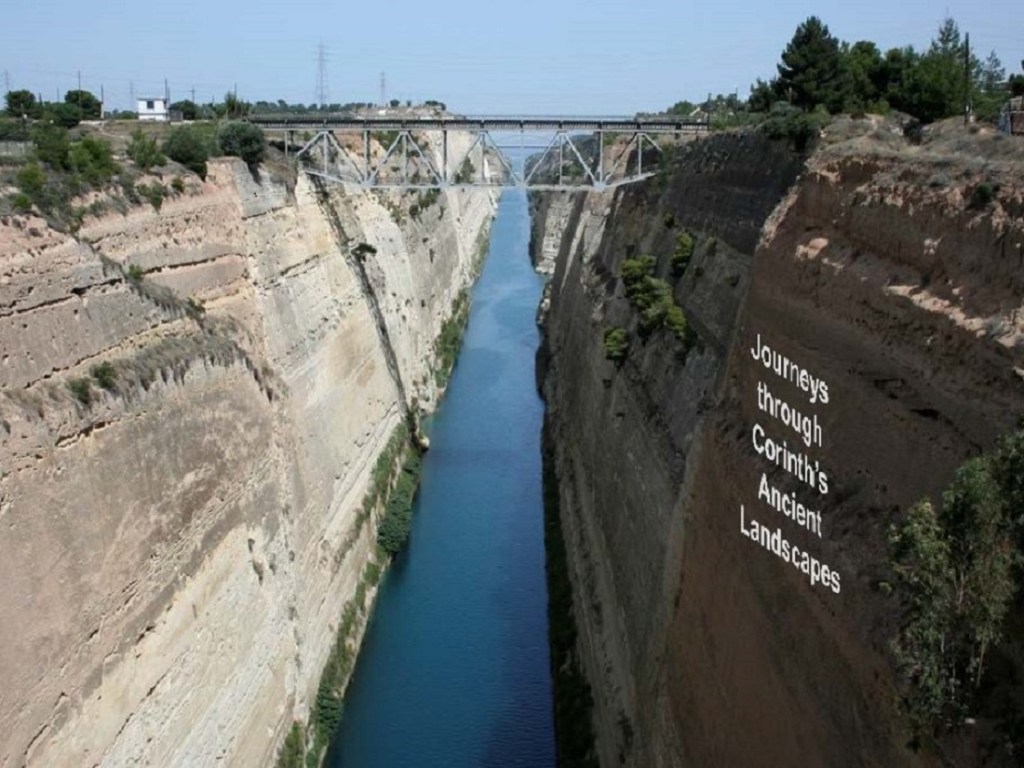
Journeys through an Ancient Landscape
I spent Thursday and Friday last week visiting St. Mary’s College of Maryland located on the beautiful site of Historic St. Mary’s City, which served as Maryland’s original state capital and ranks among America’s oldest colonial settlements. It was one of the most interesting campus visits I have had in combining my interests in ancient…
-

The Isthmus from 20,000+ Feet
I always request a window seat when I fly in and out of Athens International Airpot on the hope of capturing good images of the Corinthia. Photographer and archaeologist Jacquelyn Clements shared with me the image below from her flight in December 2013 (and kindly gave permission to share on this site). The beautiful photo clearly shows the constricting neck that defined…
-
Bridge of the Untiring Sea (Gebhard and Gregory, eds.)
I finally have my hands on Bridge of the Untiring Sea: the Corinthian Isthmus from Prehistory to Late Antiquity, fresh off the press (December 2015) from the Princeton office of the American School of Classical Studies at Athens. I wrote briefly about this forthcoming book in June (here and here). The Bridge has been a long time in the making. It…
