Category: Sites, Temple of Apollo
-

Dropping into Ancient Corinth (the CyArk and Google Partnership)
Years ago, a visitor to ancient Corinth (and other sites of Greece) had immediate access to most of the archaeological remains within the site. One could stand directly next to one of the standing columns of the Temple of Apollo, or even climb within the Fountain of Peirene, as I know a group of university…
-
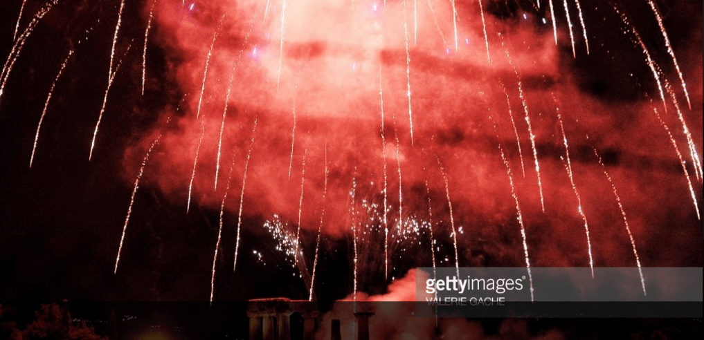
Easter Fireworks in Corinth
Valerie Gache captured this spectacular photo of fireworks over Ancient Corinth in celebration of Easter last Sunday. Check out the original image below: Embed from Getty Images //embed.gettyimages.com/embed/669047734?et=dvrJvQvpS0pErY5Ljr3NjQ&tld=com&viewMoreLink=on&sig=0v8BfJvU179Z1FCPlF7e8Z5gIe9pjIQhNLS8ERvc8ds=&caption=true
-
Corinth, Christian Encyclopedia 1866
For this Friday photo blog, I direct the viewer to this steel plate engraving from James Gardner’s The Christian Cyclopedia, or A Repertory of Biblical and Theological Literature, published in London 1866. The image, posted by Andy Brill here on flickr shows village of Corinth from the west, with the Temple of Apollo on a…
-
Life Among Ruins
The Department of Archaeology at the University of Amsterdam recently launched a new website “Byzantine & Ottoman Archaeology: Digging up answers in the Medieval Mediterranean” as the official site for their VIDI-Research Project on material culture in the eastern Mediterranean after antiquity. The project researchers Joanita Vroom, Fotini Kondyli, and Yasemin Bagci are examining the…
-
An Early Summer Evening
Photo taken by D. Pettegrew June 1, 2011.
-
An Account of Travel to the Corinthia: Major Sir Greenville Temple (1836)
While conducting research on the diolkos of Corinth last year, I discovered the enormous corpus of scanned texts in Google Books relating travel accounts to Greece and the Aegean from the late 18th to 20th centuries. These searchable texts offer the researcher an easy way of measuring historical interest in ancient landscapes. I was interested…
-
Temple of Apollo Photographs at the Benaki Museum
A recent article from the Greek Reporter highlights the photographic exhibition of James Robertson at the Benaki Museum: James Robertson was one of the first prominent traveler-photographers to depict scenes of mid-nineteenth century Greece. Of Scottish descent, he has been identified as the engraver James Robertson, who worked in London around 1830. He first settled…
