Photo of Sarah James, Corinth Excavations, 2005. Photo by David K. Pettegrew

A New Study of Hellenistic Fine Wares at Corinth

Each of the 45 individual volumes that make up the Corinth Excavation Series published by the American School of Classical Studies at Athens marks a labor of love, sweat, and tears. There are specific studies that focus on an individual building, such as the Temple of Apollo, the Odeion, or a Roman villa, unearthed through over a century of excavation and study by archaeologists. There are more general studies of a particular phase of the site, such as Scranton’s study of Medieval architecture, or general areas of the ancient site such as the volumes on the North Cemetery. Then there are systematic studies of classes of objects like pottery, lamps, and statuary. The volumes are consistently large, heavy, and neat, containing copious detail and categorization that aim to establish archaeological knowledge about a building, district, or artifact group. The labor to produce a Corinth volume can last a lifetime, and even those scholars who write them quickly may wait years in the production process.

For these reasons, there is always cause for celebration when a new volume arrives. While in the Argolid this summer, I ran into Sarah James who seemed relieved that her years and years of study and restudy of Hellenistic fine wares at Corinth had at last made it through the publication pipeline of the American School of Classical Studies at Athens.  Titled Hellenistic Pottery: The Fine Wares, the work is 360 full pages of Corinthian ceramic goodness, with numerous illustrations, figures, and plates. I haven’t picked it up yet, but I imagine it’s as heavy as any of the others in the series. James’ work has been groundbreaking both for defining a new chronology for Hellenistic pottery in Corinth and understanding the Hellenistic period in the city more broadly, including the so-called interim period between the sack by the Romans and the foundation as a colony in 44 BC. It’s also important as a presentation of both new material (from the Panayia Field excavations) and older material recontextualized. You can get a sense of the revolutionary argument from pottery in this book description from the publisher’s website (you can find TOC here):

Using deposits recently excavated from the Panayia Field, this volume substantially revises the absolute chronology of Corinthian Hellenistic pottery as established by G. Roger Edwards in Corinth VII.3 (1975). This new research, based on quantitative analysis of over 50 deposits, demonstrates that the date range for most fine-ware shapes should be lowered by 50-100 years. Contrary to previous assumptions, it is now possible to argue that local ceramic production continued in Corinth during the interim period between the destruction of the city in 146 B.C. and when it was refounded as a Roman colony in 44 B.C. This volume includes detailed shape studies and a comprehensive catalogue.

Last month, the ASCSA website posted a short interview with Sarah about the history and significance of the project that is well worth a read.

You can purchase a copy for only $150 — the cost perhaps of a typical archaeological monograph — through the publisher website, or you can pay a little less via Amazon.

Dropping into Ancient Corinth (the CyArk and Google Partnership)

Years ago, a visitor to ancient Corinth (and other sites of Greece) had immediate access to most of the archaeological remains within the site. One could stand directly next to one of the standing columns of the Temple of Apollo, or even climb within the Fountain of Peirene, as I know a group of university students did two decades ago. Open access provided physical contact with remains thousands of years old, and the first-hand experience of exploring the complexities of ancient architecture, but this was not necessarily all good. There were dangers in letting visitors climb in and among the site’s entire remains, and the monuments themselves undoubtedly suffered for the wear. Eventually, the ropes, rails, and fences came, which bounded and directed the visitor’s experience, restricting access and keeping the visitor at a distance. At some sites, such as the fenced Lechaion basilica, fences effectively barred visitors from any access except during those rare times when the site opened its gates.

Digital environments are changing all of this again. While we cannot physically touch an archaeological site remotely, the advent of new tools for exploring sites from a distance mark an exciting development in archaeology today. You may recall that at the end of the excavation season in 2015, the ASCSA Corinth Excavations reported on efforts by members of CyArk — a non-profit that preserves cultural heritage sites through 3D modeling — to recreate the Peirene Fountain and Temple of Apollo. Last week CyArk and Google Arts and Culture announced a new partnership to make 3D models of Corinth and other archaeological sites around the globe available through its free digital archive. A gallery called Open Heritage features online exhibits and 3D models of sites and monuments. As the blog for Google Arts and Culture noted,

As part of this new online exhibition you can explore stories from over 25 iconic locations across 18 countries around the world, including the Al Azem Palace in war-torn Damascus, Syria and the ancient Mayan metropolis of Chichen Itza in Mexico. For many of the sites, we also developed intricate 3D models that allow you to inspect from every angle, using the new Google Poly 3D viewer on Google Arts & Culture.


Greek Reporter provides this brief overview of the work in Greece, with links to a TED Talk with Ben Cacyra, founder of Cyark.

Remote visitors to the Ancient Corinth Exhibition may with this slideshow “Explore Ancient Corinth Expedition” which explains how CyArk created their 3D models of Peirene Fountain and the Temple of Apollo (through LiDAR and photogrammetry) and showcases videos of late antique frescoes within the fountain of Peirene.

The expedition also links to pages that allows anyone to download the data. Here’s the lead page for the expedition:

In collaboration with the American School of Classical Studies at Athens and the Hellenic Ministry of Culture, CyArk documented the mythical Peirene Fountain and the Temple of Apollo in the city of Ancient Corinth, Greece. Survey of the extant structures was conducted primarily with LiDAR and both terrestrial and aerial photogrammetry. The surviving frescoes within the Peirene Fountain were surveyed with an Artec scanner, which measures the 3D shape of a surface using pulsating light and a camera system. CyArk’s digital documentation of the temple and fountain provided the ASCS with accurate and precise data on the current state of preservation for both architectural complexes. In particular, it was important to record Peirene which is currently closed to the public due to concerns surrounding its preservation. This work was made possible through the generous support of the Macricostas Family Foundation

Then go on to explore the interactive map that allows any viewer to drop the little yellow street view figure onto any of the photogrammetry points. Voila — anyone can actually move within the Fountain of Peirene for the first time in decades. You can also explore 3D models of the Temple of Apollo and Peirene Fountain.

Recall that Google has already made available interactive imagery of Ancient Corinth through its street view feature: you can drop into almost any street in the village anytime you want. Through its “photo sphere”, you can also drop into the archaeological site and have a look around.


The Open Heritage collection along with Google Maps provides another great opportunity for teaching students and the public outside of Greece about ancient Corinth.

Ancient Corinthia and the American School of Classical Studies

Kostas Pliakos, a video journalist at CNN Greece, has produced a little three minute clip on the work of the American School of Classical Studies in Corinth and Nemea. Some nice recent footage here from those sites along with interview clips of Ioulia Tzonou-Herbst and Steven Miller. Check out the video below.

Corinthian Matters in Corinth

Next week I’ll be coming to Ancient Corinth for a week of study and research about which I’ll write more soon. I’ll be bringing 9 Messiah College history students as part of a course called “The History and Archaeology of Greece and Cyprus.” The class is designed to introduce history students to the history and culture of two very different Greek countries, and teach the value of employing archaeological methods for historical reconstructions. After our time in Corinth, we will head to Larnaca, Cyprus, to complete our final season of studying the excavated finds from the Pyla-Koutsopetria Archaeological Project.

If you’re in the Corinthia between May 16 and 21 and are interested in discussing matters of interest related to Corinthiaka, drop me a line: dpettegrew at messiah.edu. I had some great conversations last year about tourism in the region, which I’d love to follow up on.

Embracing Ancient Corinth(ia)

This short piece in New Europe surveys a management plan that would cast a broader tourist circuit linking the remains of ancient Corinth in the forum with the acropolis to the south and the northern harbor Lechaion on the north. It is sad that tour groups that deposit hundreds of people at the entrance of the Roman forum each day often miss all the other remains of the village including Roman baths, the unexcavated amphitheater, the Asklepieion, the ring of early Christian churches, even the theater–to say nothing of the extensive sites in the territory such as Isthmia, the diolkos, the trans-Isthmus walls, quarries, and the ancient canal remains.

Some great quotes here from Dr. Guy Sanders, director of the Corinth Excavations.

CORINTH, Greece – An ambitious plan to unite all the archeological sites of Ancient Corinth would make them more accessible to tourists, allowing them to embrace the history of one of the largest and most important ancient cities of Greece, British Archeologist Guy Sanders, director of the American School of Classical Studies, told New Europe at the main archeological site of Corinth.

“One of the things we’ve been working on over the last couple of years is to make a management plan for the whole of Corinth that will embrace the whole city within the walls, which includes the Castle of Acrocorinth, which was the acropolis of the city and the main archeological site of Corinth, which includes the Temple of Apollo and the Harbour of the Ancient City, which is down on the coast,” Sanders said, referring to the ancient port of Corinth in Lechaion where impressive findings were revealed.

….“It’s finding new stories from old material. It’s digging basements and storage rooms rather than digging dirt,” he said.

Read the rest of the piece here: “Embracing Ancient Corinth

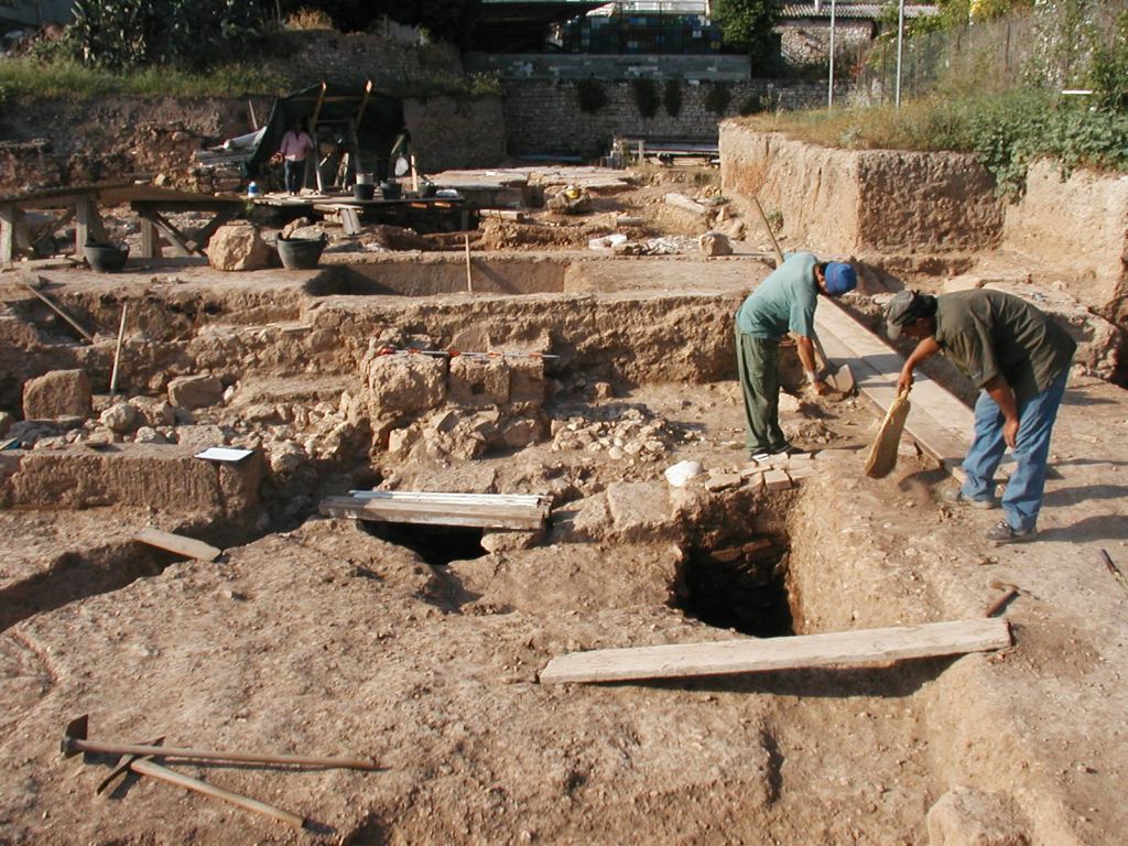
Corinth Excavations Archaeological Manual Published

Virtually anyone who has participated in the American School Excavations at Corinth has become acquainted with the Corinth Excavations Archaeological Manual. I’m not sure who was responsible for writing the first excavation manual for Corinth, or when it first appeared in print, but having an archaeological manual that guides fieldwork and recording is simply good archaeology. It gives workers and students help in making decisions in the field and ensures that excavation occurs in a responsible and systematic manner — producing data scholars can use to understand cultural deposits, buildings, and contexts and the formation processes that have transformed them. In the case of Corinth, a good printed field manual has been a constant guide for the student regular members of the American School of Classical Studies who come to the site every May-June for training.

2005 Excavations

The Corinth manual has grown over the years into a comprehensive and authoritative guide to open-area, stratigraphic excavation, covering everything from excavation of pits, wells, and robbing trenches to the removal of deposits to inventorying objects in the museum. The cohort of graduate students with whom I worked at the Panayia Field back in 2005 frequently referred to the paper versions of the manual in the field until the processes and guidelines became second nature. When I began excavating Hellenistic and Late Roman Cyprus in Cyprus with fellow Corinthian archaeologists in the Pyla-Koutsopetria Archaeological Project, we borrowed and adapted much of the Corinth manual to our excavations.

All this to say that the announcement today of the publication of the manual by The Digital Press of the University of North Dakota is great news. The work, authored by Guy Sanders, Sarah James, and Alicia Carter Johnson, with contributions by Ioulia Tzonou-Herbst, James Herbst, Nicole Anastasatou, and Katerina Ragkou is now available for free download at the the Digital Press website, or you can purchase a print paperback addition for a small cost. The publisher page describes the work in this way:

The Corinth Excavations Archaeological Manual is the first major field manual published from an American excavation in Greece and among a very small number of manuals published from the Eastern Mediterranean in the last generation. The appearance of this book is timely, however, as there is a growing interest in field methods and the history of excavation practices throughout the discipline of archaeology. Moreover, Corinth Excavations has long held a special place in American archaeology in Greece as the primary training excavation for graduate students associated with the American School of Classical Studies at Athens. As a result, the field manual has had a particular influence among American excavators and projects in Greece, among Mediterranean archaeologists, and in archaeology classrooms.

And the preface to the manual begins:

This manual describes the present state of archaeological practice at ancient Corinth, Greece. The system employed here has evolved over five decades of excavation and in response to both the nature of the anthropogenic activities and the ultimate goals of the excavation: a diachronic archaeological and cultural history of Corinth. The practicalities of removing archaeological material from the ground, recording it, analyzing it, and storing it for future use have been developed over the past 100-plus years of archaeological exploration, and they are well-suited to the field here, to the post-excavation methods used, and to the facilities available at Corinth.

I see a number of good, concrete benefits in this publication. It puts into (digital) print / final form the comprehensive methods of a major excavation in Greece at this point in time. There’s a tight relationship of course between process and product in archaeology: how you investigate the archaeological record relates in direct way to what you can say about past human activity. Indeed, I wish this new manual included a little historical and reflective overview of how excavation manual has grown and changed over time. Perhaps this could be included in subsequent editions, and I hope this publication might be followed by the publication of subsequent editions reflecting new developments in archaeological procedures.

The work will also be very valuable as a teaching tool. Besides its immediate uses in training American School students in the Corinth Excavations, I could imagine assigning this in my own class in Historical Archaeology. Certainly other professors who teach classical archaeology or archaeological method could use this work alongside other freely available archaeology manuals online (thanks, Bill Caraher!). But the publication could also be made available even in courses in textual fields such as New Testament studies that devote a little time to how archaeology contributes to our understanding of Roman cities. The work is rich in illustrations mostly produced by architect James Herbst. Check out the two below for examples.  

 
The publication of the Corinth Excavations manual marks another positive step toward a more reflexive archaeology that situates contexts, finds, and buildings in concrete contexts and processes of investigation. Congrats to the Corinth crew and the Digital Press in providing access to their work. For more information about the manual, check out Bill Caraher’s press release today.

Sunrise in the Village

Last day of my whirlwind tour in the Corinthia. I’ve continued meeting and running into old archaeology friends from Isthmia and Corinth, talking with local friends about the feasibility of a visit with students next year, and taking lots of pictures. This one comes from my morning run around the village of Ancient Corinth.

Sunrise over the church of the Panayia, photo by David Pettegrew, May 30, 2016

Ancient Corinth via Drone

After last month’s post about helicopter views of Corinthian coasts, I was pleased to discover Dronestagram, a site that allows owners of drones to share their photos and videos. This two minute sequence of the site of Ancient Corinth offers low-altitude coverage of the archaeological site as well as the Greek theater and Odeion. Now that the technology is available, expect many more of these in the future. These kinds of videos provide new perspectives on archaeological sites which will certainly be useful in the classroom.

CorinthDrone2
CorinthDrone3

Forthcoming Publications of the American School of Classical Studies

I received a little pamphlet in the mail on Saturday about forthcoming publications of the ASCSA in 2016. Since some of these have been in production for years, I’ll save more detailed comments until the works actually appear in print. Forthcoming books include studies from Corinth, Isthmia, and the Nemea Valley, as well as the revised site guide to Corinth. I have provided links to the press pages for each book.


AncientCity – Urbanization through Geoinformatics

Updated March 21, 2016 with italicized additions and strikethrough. See also this update.

*****************************************************

At the 8th Congress of the Balkan Geophysical Society, held in early October in Chania, Crete, a group of authors presented a paper on a new project called AncientCity – A new Frontier in Ancient Greek Urbanization through Geoinformatics. I don’t see that the project has its own web presence yet, and I’m not sure what will become of it, but the scope and aims sound interesting if not a little ambitious. Corinth, of course, is one of the case studies. The project website lives here. Here’s the abstract:

AncientCity is a project consisting in the use of new perspectives in studying the ancient Greek urbanism through modern and advanced technological tools. The understanding, reconstruction and development of ancient Greek cities is approached through an integrated protocol composed of satellite / aerial remote sensing, multicomponent geophysical prospection and spatial analysis within a Geographical Information System platform. This approach involves the use of digital applications to detect patterns in the buried ancient built environment, the identification of surface and subsurface features through non-destructive archaeological fieldwork and the creation of digitized thematic plans of ancient Greek settlements. Five archaeological sites from two different greek geographical regions (central Greece and Peloponnese) were chosen to incorporate new urban models and recalibrate the traditional narratives about the development of the Greek city. The encouraging results of this integrated approach can be used as a prototype model for the employment of Geoinformatics in the historical and archaeological sciences within the subfield of Mediterranean archaeology and Greek Urbanization.