Category: Periods
-

A New Study of Hellenistic Fine Wares at Corinth
Each of the 45 individual volumes that make up the Corinth Excavation Series published by the American School of Classical Studies at Athens marks a labor of love, sweat, and tears. There are specific studies that focus on an individual building, such as the Temple of Apollo, the Odeion, or a Roman villa, unearthed through…
-

Dropping into Ancient Corinth (the CyArk and Google Partnership)
Years ago, a visitor to ancient Corinth (and other sites of Greece) had immediate access to most of the archaeological remains within the site. One could stand directly next to one of the standing columns of the Temple of Apollo, or even climb within the Fountain of Peirene, as I know a group of university…
-

A Coin Hoard at Lechaion is not the Real Story
Some more Corinthian clickbait hit us last week in a series of news articles about a coin hoard from Lechaion. We have heard quite a bit in the past about the Lechaion Harbor Project (LHP), a Danish and Greek operation to document the underwater remains at Lechaion since 2013. Their press releases, which come at the…
-

Federalism in Greek Antiquity (Beck and Funke, eds.)
This new edited collection of essays on federalism and interstate interactions in Greek antiquity caught my eye when it was published late in the fall: Beck, Hans, and Peter Funke, eds.. Federalism in Greek Antiquity. Cambridge University Press, 2015. As the publisher page notes, this is the first comprehensive study of the subject since the publication of…
-

Chemical and Microscopic Analysis of Attic and Corinthian pottery (Chaviara and Aloupi)
This article (in press) by Artemi Chaviara and Eleni Aloupi in The Journal of Archaeological Science: Reports, examines the chemical and microscopic properties of black-glaze vessels from the Athenian Acropolis, Boeotia, and the potter’s quarter in Corinth. I tried to access the piece via my institution’s website but ran into problems. For now, I can only copy the metadata and abstract below:…
-
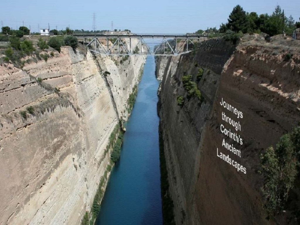
Journeys through an Ancient Landscape
I spent Thursday and Friday last week visiting St. Mary’s College of Maryland located on the beautiful site of Historic St. Mary’s City, which served as Maryland’s original state capital and ranks among America’s oldest colonial settlements. It was one of the most interesting campus visits I have had in combining my interests in ancient…
-

Ancient City: Application of Novel Geo-Information Technologies in Ancient Greek Urban Studies
I received an email from Jamie Donati who kindly shared with me more information about the Ancient City project and website, which provides the: aims and scope of the project (including digitization, remote sensing, geophysical mapping, GIS analysis, and dissemination) archaeological sites of the Peloponnese under study technical reports about geophysical survey and remote sensing presentations and publications (with available downloads)…
-

AncientCity – Urbanization through Geoinformatics
Updated March 21, 2016 with italicized additions and strikethrough. See also this update. ***************************************************** At the 8th Congress of the Balkan Geophysical Society, held in early October in Chania, Crete, a group of authors presented a paper on a new project called AncientCity – A new Frontier in Ancient Greek Urbanization through Geoinformatics. I don’t see that the project has its own web presence yet,…
-

Early Byzantine Pottery from a Building in Kenchreai
Back in August, I noted that the American Excavations at Kenchreai had developed its own website and digital archive for artifacts recovered from investigations of the last half century. I was pleased to see later in the fall the release of this preliminary report about an assemblage of late Roman /early Byzantine pottery found in a sea-side building excavated by the Greek Archaeological Service in 1976,…
-
On the Churches and Saints of Corinth
Tomorrow marks the feast day of Kodratos, Corinth’s most famous ancient country saint martyred during the reign of the Emperor Decius. As I noted a number of years ago when I paraphrased a Latin version of his life, Kodratos was Corinth’s quintessential rural saint: an orphan raised by his Father God in the fields and mountains after his parents’ early death. When he descended into the city of sin…
