New Management Plan for the Archaeological Site at Corinth

The Mediterranean Institute for Nature and Anthropos (Med-INA), a non-profit scientific organization based in Athens, Greece, has just issued this press release concerning its role in creating a new management plan for the archaeological site of ancient Corinth.

Located in North-East Peloponnese, Ancient Corinth is an unparalleled world heritage site. Overseeing two regions and two seas, and endowed with a wealth of natural resources, it was one of the largest and most important cities of Archaic and Roman times and experienced continuous habitation over the centuries. The sequence of peoples and cultures that ruled the land – Greeks, Romans, Franks, Ottomans, and Venetians – left their mark in the history but also on the natural and built environment of the area.

The impressive acropolis, the Acrocorinth, stands as an impressive fortress landmark not far from Ancient Corinth, where the extended Roman forum is located at the centre of the modern-day settlement. Further to the north, the Roman harbour is now an abandoned wetland, located in a dynamic rural seashore that faces enormous urban sprawl pressures. These three sites, along with an extensive network of monuments that are scattered in the fertile plain, constitute the unique archaeological area of Ancient Corinth.

In 2014 the Greek Ministry of Culture set up a Working Group with members from the Corinth Archaeological Ephorate, the American School of Classical Studies in Athens (ASCSA) and the Ministry to work on a plan for the sustainable management of the natural and cultural heritage of the area. Med-INA and specifically Mr. Yorgos Mellisourgos, a member of the scientific secretariat specialised in architecture and planning, is jointly working with TPA, which was commissioned by ASCSA for leading the plan development and for providing expert consultation to the Working Group.

The development of the management plan evolves in two phases (analysis and synthesis). The first step of Phase 1 is a multi-themed inventory and assessment of current conditions which was completed in 2015. The second step, currently in progress, is the development of a strategic vision for the area of Ancient Corinth.  This will be followed by a round of consultations with key stakeholders in order to move on to Phase 2, which is the design of the management plan.

Few details here about what the plan will involve but it sounds like a promising start for developing the management of the archaeological site.

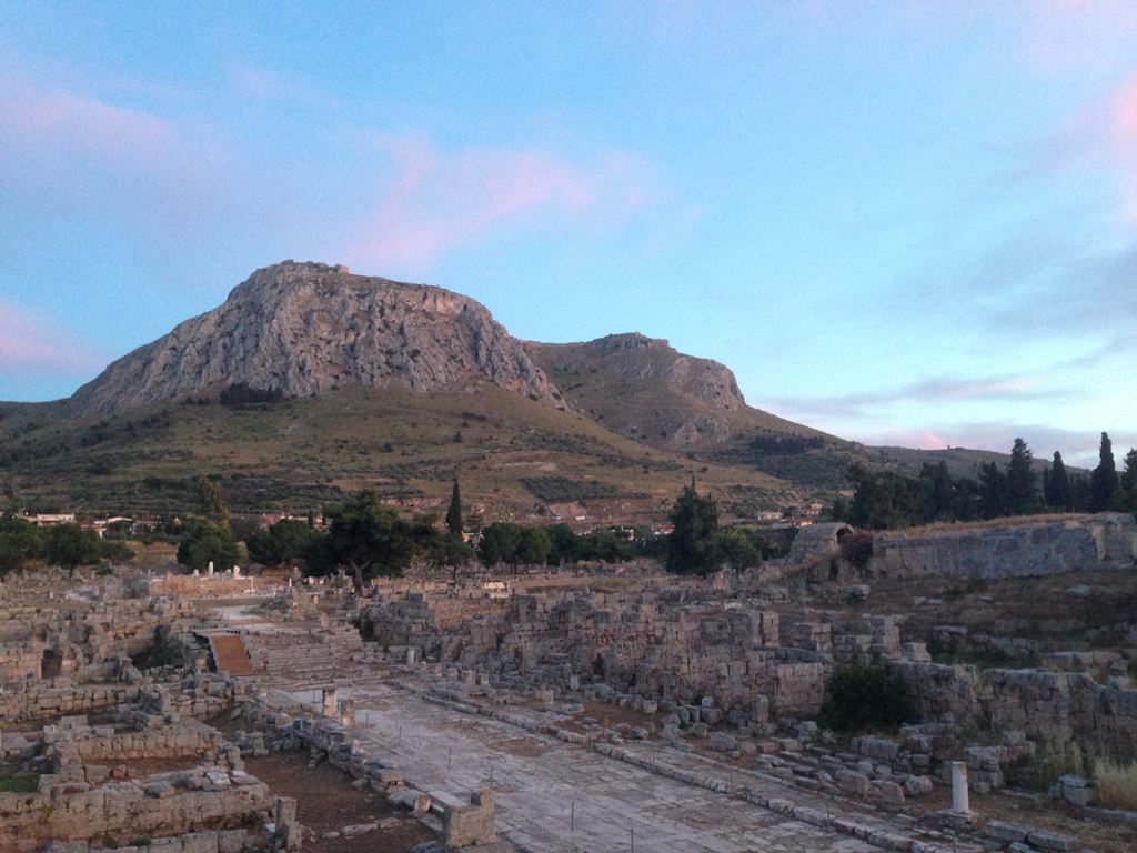
Archaeological Sites and Hours

Planning a trip to the Corinthia soon? The Greek Ministry of Culture and Sports has been slowly adding data since 2012 related to the major sites of the Corinthia through their ODYSSEUS Portal. Posted information includes access and hours, ticket pricing, student discounts, amenities, suggested bibliography, among others. Mind you, hours and times are subject to change, but the information will at least get you in the ballpark.

Close the window

There’s a small collection of images associated with the site pages. Check out this beautiful aerial photo of Lechaion harbor from the Lechaion Port page.

I have added these links to a new sidebar titled “Corinthian Sites – Hours and Access”.


Caveats added Feb. 27 from G. Sanders’ comments on the Corinthian Studies Facebook page: If you’ve been to Corinth before, don’t count on the old way of getting there. The bridge was just removed at the exit to (ancient) Corinth to widen the Athens-Patras highway. If you stay on the highway to Patras, you’ll have to double back at Kiato. To arrive at Corinth, exit at the Isthmus, or take the exit to New Corinth (the first exit after the Isthmus). If you exit to new Corinth, turn left and then make a hard right, or make a right and then left past the train station.

Re: hours. New guards are being hired and the site will be open 8 AM to 8 PM during summer months.

The Corinthia and the Northeast Peloponnese

Thanks to Jeremy Ott in notifying the Corinthian Studies FB group that the long-awaited publication of the Loutraki 2007 conference is now available in print:

W.-D. Niemeier and N Kissas, eds., The Corinthia and the Northeast Peloponnese: Topography and history from prehistoric times until the end of antiquity. 2013: Hirmer Verlag GmbH.

81TnpDrT73L._SL1400_

I’m guessing these will be in limited supply, and there certainly won’t be a paperback version, so I ordered myself a copy.

Here’s a description of the book at Amazon:

In March 2009 the international conference for which this volume is named was held in Loutraki by the 37th Ephorate of Prehistoric and Classical Antiquities in collaboration with the Greek Ministry of Culture’s Directorate of Prehistoric and Classical Antiquities, and the German Archaeological Institute of Athens. The results of research carried out by international research institutes and individual researchers working in Corinthia, and first and foremost by the Greek Antiquities Service, were presented at the conference.

I’ll give it a fuller overview when my copy arrives.

A New Roman Tomb in Corinth

Construction activities across Corinth’s coastal plain and Isthmus  have frequently turned up spectacular remains of the city’s Greek and Roman past. Large-scale construction projects like the highways and rails especially have generated discoveries and led to salvage excavations. While salvage excavation employ methods that are not ideal, they do generate discoveries that end up in synthetic assessments of the Corinthia and contribute in aggregate to a greater knowledge of the city. Visit Wiseman’s Land of the Ancient (1978), for instance, and you’ll find numerous reports of sites found through construction projects in the territory.

In recent years, the construction of the high-speed railway and the new Corinth-Patras highway has cut through a number of amazing contexts. The construction of the high-speed railway nearly a decade ago led to the discovery of remarkable sarcophagi buried several meters deep in the soils immediately north of Ancient Corinth. The building of the new Patras-Corinth highway has likewise turned up interesting remains. A year ago July, Το Βήμα announced the discovery of the Archaic wall.  And Friday’s issue of Το Βήμα announced a new Roman tomb discovered in January during the construction of the same highway.

The underground chamber tomb is evidently dated to the 3rd century AD and measures about 2-1/2 meters in length and width. It has exceptional wall paintings with paints still preserved and two decorated sarcophagi. While one of the sarcophagi is not well preserved, the other contains a picture of a beautiful young woman lying on a bed. There are painted garlands, flowers, bows, and a peacock.

Κόρινθος: Κρυμμένη ομορφιά σε έναν τάφο

Interestingly, there are plans to transfer the tomb for display to the archaeological site of Corinth.

I am curious about the dating of the tomb – is this an argument from stylistic grounds? As the third century has been remembered as a pretty dismal time in the Mediterranean, this discovery would provide another glimmer of private investment and wealth.

Thanks to Vassiliki Pliatsika for posting this to the Corinthian Studies facebook group.

Did a tsunami destroy ancient Lechaion?

In early July, Andreas Vött and his colleagues announced that sometime in the 6th century AD, a tsunami destroyed ancient Olympia, the famous site of pan-Hellenic athletic contests.   In considering recent scholarship on historical tsunamis in the Gulf of Corinth, I pondered here at Corinthianmatters whether there was any evidence for tsunamis in the Corinthia.  As it turns out, a workshop on tectonics and earthquake geology occurred in late September that included presentations on the subject. The papers at the workshop have now been published as short articles in Earthquake Geology and Archaeology: Science, Society and Critical Facilities and include two relevant articles, both of which consider tsunamigenic deposits at Lechaion:

  • Hadler, Hanna, Andreas Vött, Benjamin Koster, Margret Mathes-Schmidt, Torsten Mattern, Konstantin Ntageretzis, Klaus Reicherter, Dimitris Sakellariou, Timo Willershäuser, “Lechaion, the Ancient Harbour of Corinth (Peloponnese, Greece) destroyed by Tsunamigenic Impact,” pp. 70-73.
  • Koster, Benjamin, Klaus Reicherter, Andreas Vött, Christoph Grützner, “The Evidence of Tsunamigenic Deposits in the Gulf of Corinth (Greece) with Geophysical Methods for Spatial Distribution,” pp. 107-110.

Some of the same researchers (Hanna Hadler, Andreas Vött, Konstantin Ntageretzis, Timo Willershäuser) responsible for this work also published the Olympia tsunami.  Indeed, the Olympia and Lechaion studies are both part of a broader study of tsunamis in the Ionian Sea and the Peloponnese.  The Hadler et al. paper is especially intriguing.  The abstract:

Lechaion, the harbour of ancient Corinth, is situated at the south-eastern extension of the Gulf of Corinth (Peloponnese, Greece).  Due to extensive fault systems dominating the gulf, seismic activity is frequent and often related to landslides or submarine  mass movements. Thus, the  study area is highly exposed to tsunami hazard. By means of geo-scientific studies comprising geomorphological, sedimentological and geophysical methods,  evidence of multiple palaeotsunami impact was encountered at the Lechaion harbour site and the surrounding coastal area.  The detected tsunami signatures include allochthonous marine sediments intersecting  quiescent  harbour  deposits, extensive  units of tsunamigenic  beachrock  and geoarchaeological destruction layers. Our results suggest that the harbour at Lechaion was finally destroyed in the 6th century AD by strong tsunami impact

I asked Dr. Richard Rothaus of Trefoil Cultural and Environmental Heritage if he would review the Lechaion piece as guest blogger.  Rothaus offers an expert opinion in multiple ways.  He published the seminal English article in OJA on the harbor of Lechaion, discussed the late antique phases of Lechaion harbor and basilica in his book Corinth: The First City of Greece (2000) and, in his role as coastal archaeologist in the Eastern Korinthia Archaeological Survey, took vibracores at Lechaion.

What follows is Rothaus’ review as well as a report on his own work at Lechaion.  I have added several images as visuals for the discussion.

***************************

The Second International Workshop on Active Tectonics, Earthquake Geology, Archaeology and Engineering 19th-24th September 2011 contains several articles about the palaeoseismicity of the Corinthia, as Dr. Pettegrew has already indicated. I am particularly interested in the papers on Lechaion.  I became interested in the harbor at Lechaion at the first INQUA meeting in Corinth, and worked with several palaeoseismologists, under the lead of Stathis Stiros in investigating the coseismic uplift on that harbor. Stiros and his team published a paper in Geoarchaeology suggesting a possible c. 600 BC construction date for Lechaion. The borings of marine mollusks Lithphaga lithophaga L. with a clear upper terminus were observed on the interior face of the limestone blocks lining the channel that connects the inner harbor to the Corinthian Gulf.

Lechaion

Figure of Lechaion Basilica, the innner and outer harbors, and Roman land division patterns (after Romano 2003, Fig. 17.19)

Lithophaga generally live in the sublittoral zone, and those that are established in the midlittoral zone are not long preserved due to bioerosion. The preservation of lithophaga borings on the wall has been interpreted as an indication of sudden coseismic uplift. Samples were removed from two shells in living position, and AMS radiocarbon dates indicate a date between the fifth and third century BC. The researchers have interpreted this to indicate a construction date prior to an uplift event of greater than 1 m (and that excludes correction for sea-level change). I was a coauthor on this paper, and also published an archaeological overview of the harbor at Lechaion that included that date in the Oxford Journal of Archaeology.

Corinth Tour 010

Lechaion Harbor mounds and moles viewed from Korakou to the east

More importantly (at least for me) I also learned at that INQUA meeting that earthquakes and coseismic phenomena (e.g. uplift, tsunamis) are far more complicated than I ever suspected.

Subsequent to the meeting and those publications, I began a closer study of seismic and coseismic evidence in the archaeological record with my colleagues Eduard Reinhardt and Jay Noller. That study has taken many interesting turns, including visits within a few weeks of events to earthquake-stricken areas in Turkey in 1999-2000, and India in 2001. Those visits solidified our concerns that the evidence for earthquakes in the archaeological record is very, very difficult to read. Likewise we became increasingly aware of how localized co-seismic phemomena can be. Some of our results from Turkey were published in Natural Hazards, and I used the results from India to highlight the unreliability of the literary record here. Most recently I assisted Simon Donato in identifying allochthonousmaterial to document the impact of the 1945 Makran Trench earthquake in Pakistan on the shores of Oman.

As part of our study, Dr. Reinhardt and I pulled vibracore samples from the interior of Lechaion harbor for sedimentary and micropaleontological analysis.  While the results of those cores has not yet been published, one conclusion seems certain.  I was quite wrong in the 1995 and 1996 articles, which suggest the harbor went out of use quite early.  All indications are that the harbor at Lechaion continued into use well in the 5th or 6th centuries AD (a conclusion also reached by the INQUA authors). I can’t explain the early date of the lithophaga shell, but we have numerous C14 dates from our cores that indicate otherwise. Our hesitancy in publishing this material has been driven by our increasing awareness of just how very complicated the palaeoseismic and archaeological records are for Lechaion.  Lechaion is a shallow harbor in the Gulf of Corinth, and there are numerous phenomena that have impacted the record there, including harbor construction, coseismic uplift and sea-level change.  Trying to isolate those causes from one another has proven most difficult.

I was very happy therefore to see that the 2011 INQUA volume contains two strong papers on Lechaion.  Hadler et al. conducted a study to identify “allochthonous high energy events” within the sedimentary record of the harbor. In simpler words, they pulled cores and looked for things that would not normally be found in calm harbor.  When a tsunami occurs, even a small one, sediments and marine creatures normally found in deeper waters can be tossed inland.  Donato’s work in Oman relied on a similar approach, and he identified tsunami deposits by locating articulated marine bivalves farther inland than they could have been carried by tidal activity or a storm surge.

When Reinhardt and I pulled the cores over a decade ago, tsunamis were not much in our thinking. In our 1999 investigation of the Izmit earthquake we documented a localized tsunami generated by submarine slumping of sediments.  Hadler et al.note that the Gulf of Corinth is similarly susceptible to such events, and they focused their study of Lechaion on identifying these. The authors identify potential tsunamigenic impacts from the 8th century BC to the 6th century AD based on their vibracores. They also hypothesize that the gravel and marine material burying the Lechaion basilica is a result of tsunami backflow, ultimately suggesting a large 6th century AD tsunami. They also suggest that beachrock in the area may be related to the tsunami.

clip_image002

Vibracoring (Korphos) Eduard Reinhardt, Fleur Leslie, Lee Anderson, Richard Rothaus

clip_image004

Vibracoring (Lechaion) Fleur Leslie

Hadler and colleagues make some interesting suggestions, but I am not fully convinced. The beachrock idea is new to me, and I am still researching that.  The idea that the Lechaion basilica was buried by tsunami backflow I find least convincing, despite the added geophysical evidence of backflow provided by Koster et al.  The harbor, beach, and basilica lie just above sea-level and are well within the reach of storm surges.  In many years of working in the area I have seen storm surges cover and uncover archaeological features in and around the harbor. Postulating a tsunami seems unnecessary.  A few extremely large storm surges could create the same backwash and burying effect.  The good news is that this is a “knowable unknown.”  Careful excavation or coring of these sediments would allow grain-size analysis to be conducted.  Variations in grain-size (or lack thereof) would very likely identify the number and timing of events responsible for burying the basilica.

I also think, however, that the archaeological record at the basilica is very complicated. Many visitors have asked the obvious while gazing upon the foundations of the folorn basilica: where is the rest of the building?  The answer is, of course, all over. The blocks and columns and walls were carted away for reuse.  Disassembling and removing what was at the time the largest basilica in the world created a huge amount of debris and disturbance.  I think some of the materials burying the basilica remnants are a byproduct of that work.  But that also is something careful study could identify.

DSCN8019 (CM)

Part of the Lechaion Basilica with the inner harbor (white) in center-left and Acrocorinth in the background.

Hadler et al. also identify tsunamigenic elements in their cores.  This I find more intriguing but complicated by the same issues holding back our study.  The deposition of sediments in the harbor is controlled by multiple phenomena.  The shallow harbor of Lechaion is particularly difficult for two reasons.  The first is coseismic uplift.  The entire coastline is being uplifted, and there has been uplift since the harbor was constructed.  When uplift occurred, the harbor would have been isolated from the Gulf.  Over time the topography of the gravel beach would have shifted from steep to level, and eventually a storm surge would push itself into the harbor.  As uplift repeated, so would these events.  But a second issue makes this even more complicated.  The level of the Corinthian Gulf has risen about a meter since Roman times.  Sea level rise has been gradual, and this is extremely difficult (if not impossible) to identify in sediment cores.  Combine that sea level rise with uplift, storm surges, and possibly tsunamis and you have a very complex record indeed.  This is one reason why the results of our study at Korphos, a Corinthian harbor that is subsiding, have already been published–the variables are easier to control when coastlines are going down than when they are going up. The tsunami hypothesis is intriguing, and gives us one more factor to consider.

DSCN8005 (CM)

Lechaion Basilica from the west, with dredge mound visible in distance

In sum, the authors provide some much needed hard evidence in the consideration of the geological and archaeological history of the Lechaion harbor and basilica. Their data, if incorporated into a study that controls for all the environmental variables, will be a valuable contribution indeed.  On a personal level, I also am happy to see independent confirmation of my idea that localized tsunamis are something we need to be considering. That idea took us into the heart of disasters in 1999-2001 and I like to think the difficulties were worthwhile.

Kouroi arrive in Corinth

When I was in Corinth in early June, a news item going around the village was the imminent arrival of Archaic-period kouroi to the archaeological museum at Corinth.  The statues, depicted in the images below (from Greek Reporter and Athens News), were found in Klenies (see map below), a village of the southern Corinthia near ancient Tenea.  Dug up by antiquities dealers, who were trying to sell them for 10 million Euros apiece, they were confiscated by police last October and arrived last week in Ancient Corinth where they will be on display. The Greek Archaeological Service has since conducted excavations at the Archaic and Classical period cemetery in which they were found.

Brief news stories:

Thanks to Kostis Kourelis for alerting me on the Kathimerini story.

Map_Klenies_Corinthia

Service Excavations Unearth Corinth City Walls (and other buildings)

Last week the Greek newspaper To Bima released a news article announcing new discoveries from excavations at the northern end of the village of Ancient Corinth.  The excavations, carried out by the Greek Archaeological Service in advance of the construction of the new Eleusis-Corinth-Patras highway, revealed part of Corinth’s ancient city wall dating to the Archaic age (6th century BC).  The section of wall runs 80 m long and is preserved to a height of 1.6-3.2 m.

Στο  φως το  αρχαίο  τείχος της Κορίνθου


In addition to this wall, the excavations also brought to light other ancient buildings including a Mycenaean settlement, Geometric and Archaic shrines / cult places, an enormous building of late Hellenistic date (2nd c BC), a metallurgical workshop of Protogeometric date, tombs, and a quarry.  In the quarry was found a well 17 m deep and 1.15 m in diameter filled with pottery and tiles of archaic date.

Thanks to Jamie Donati for bringing this article to my attention.